Socotra
April 2025
All photos are my own; shot on Fujifilm XT30.
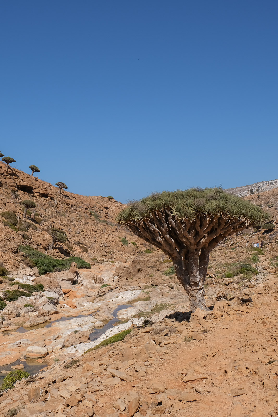
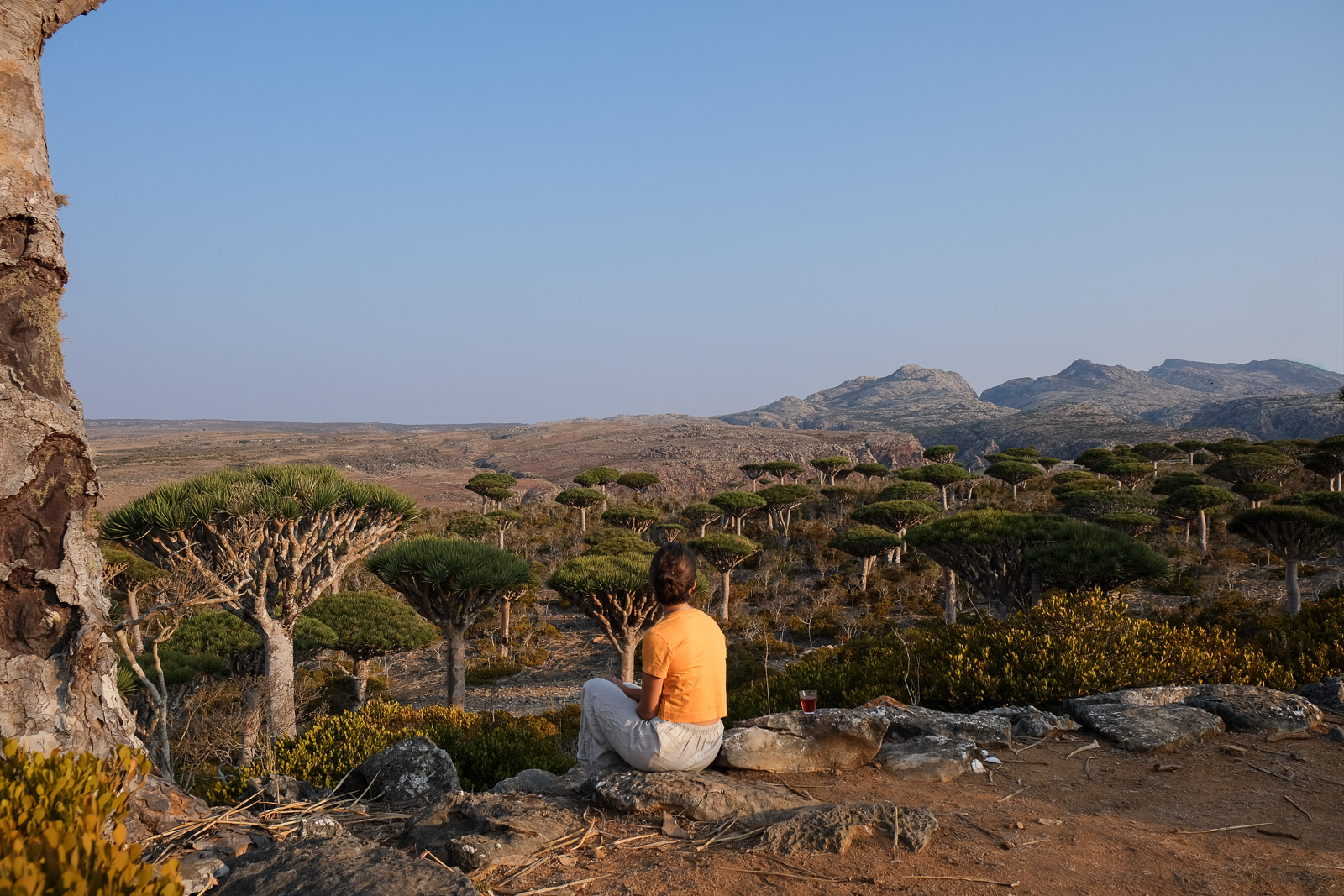
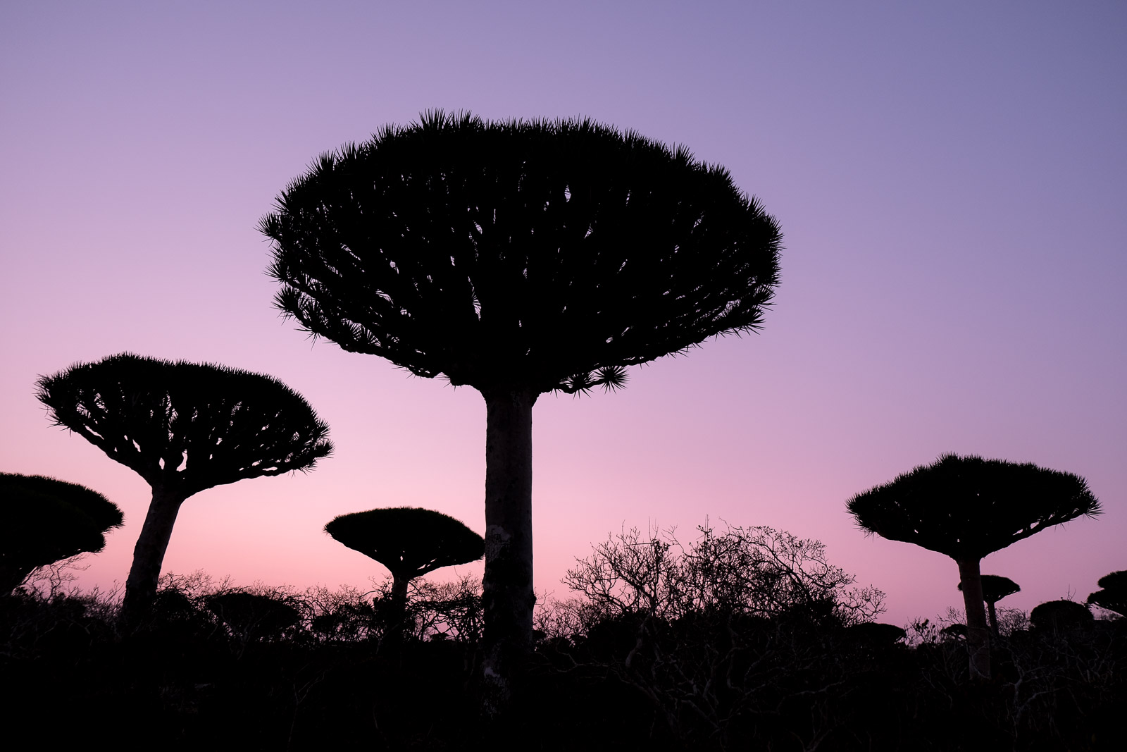
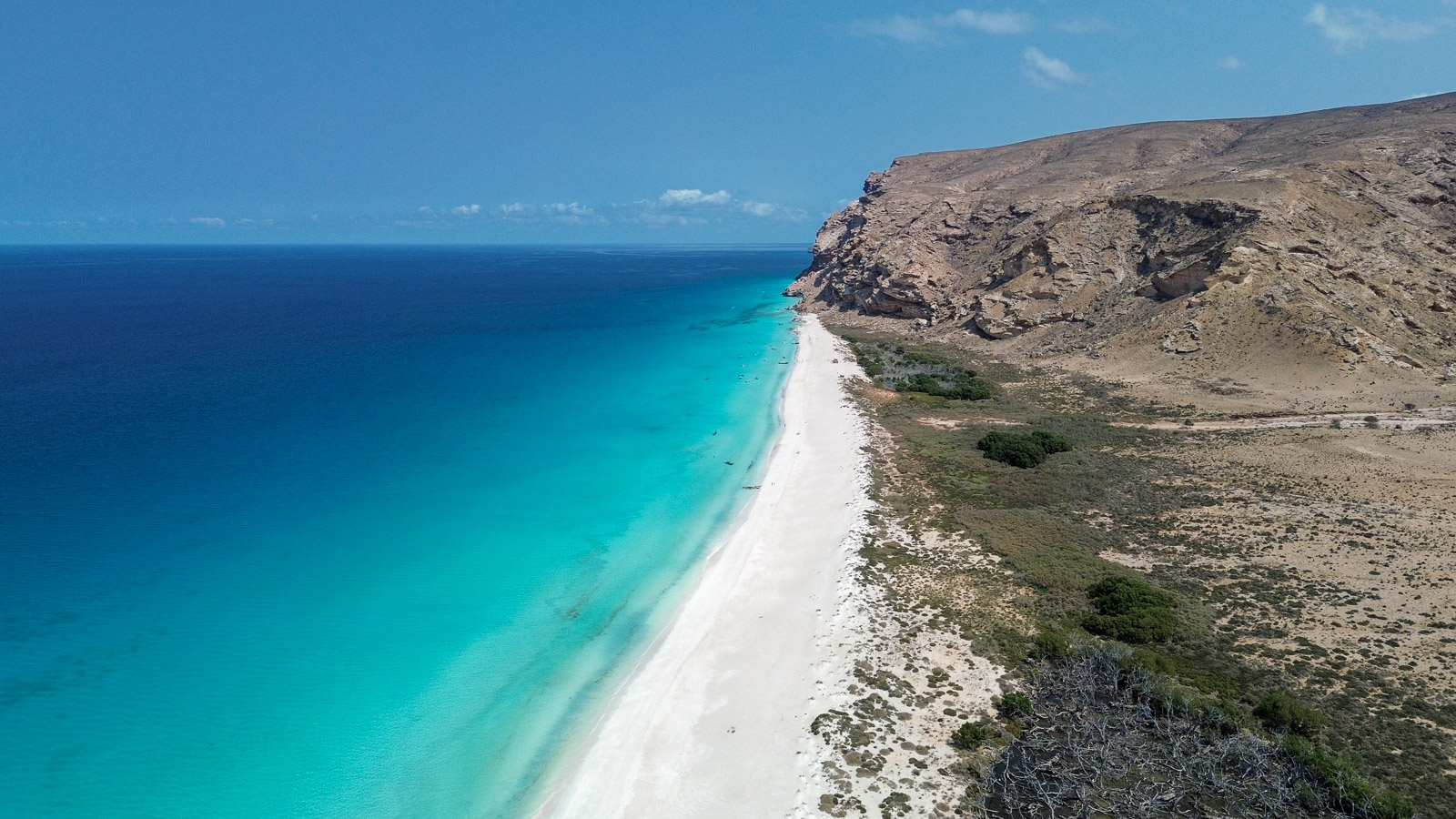
Socotra, an isolated island in the Arabian Sea, is defined by its surreal landscapes with towering white dunes spilling into turquoise water, limestone plateaus, and valleys dotted with the iconic dragon's blood trees. Much of what grows on the island exists nowhere else on Earth, giving the Yemeni island an almost otherworldly character.
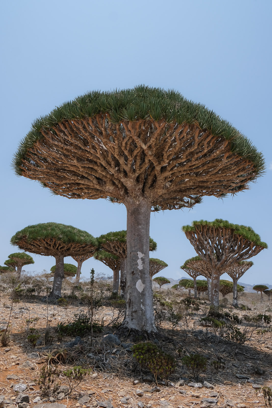
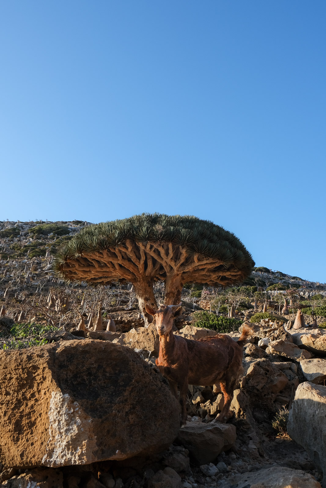
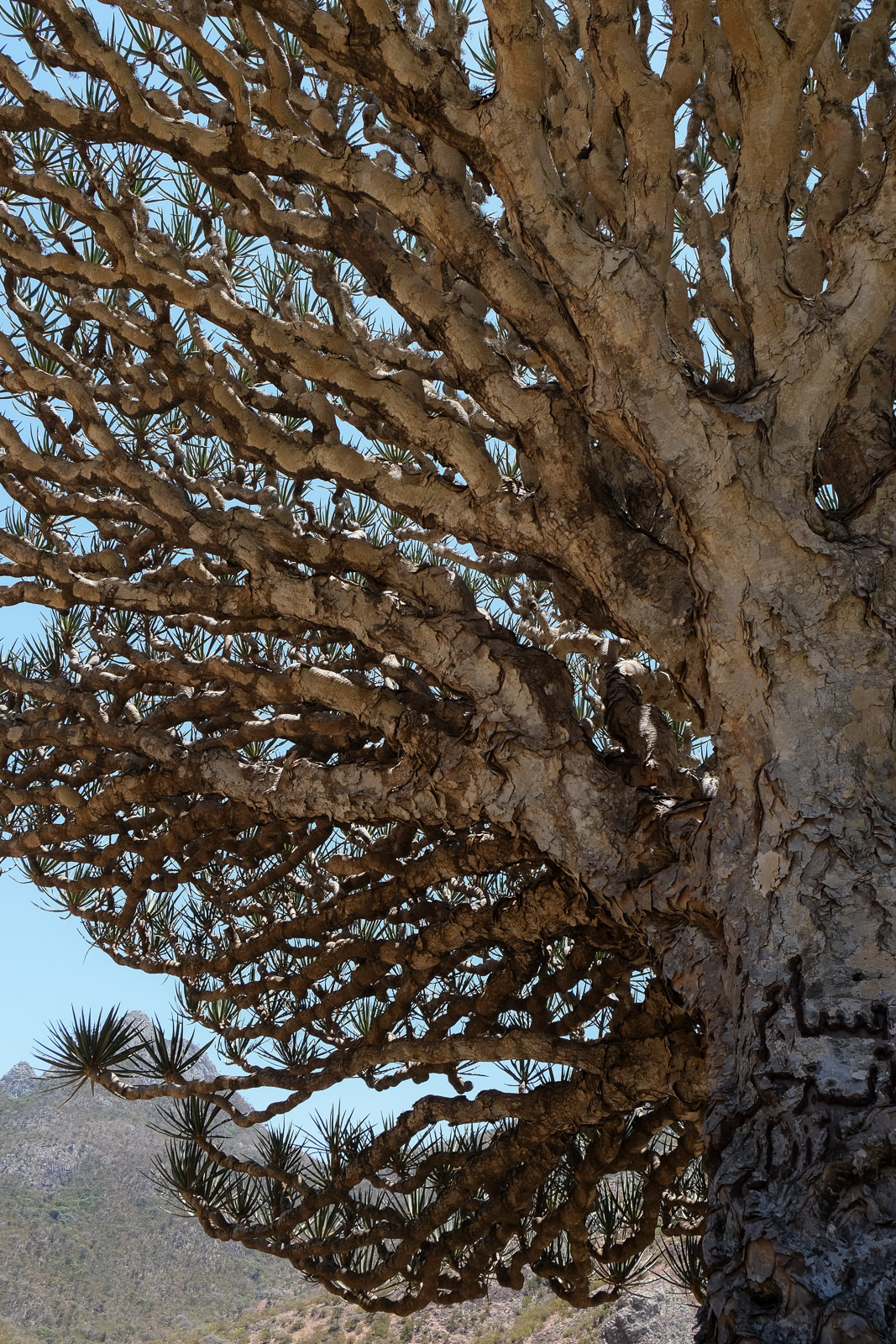
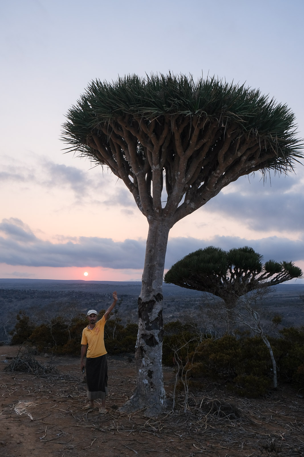
It was images of the dragon's blood tree that first put Socotra on the travel map for me. Native to the island, the tree is instantly recognizable for its striking umbrella-shaped canopy. Its name comes from the deep red resin it produces, dragon's blood, which has been used for centuries in medicine, dyes, and incense.
The more I read about the island's remoteness and biodiversity, the more determined I became to visit the island before it inevitably became more accessible to mass tourism.
Logistics
Flights
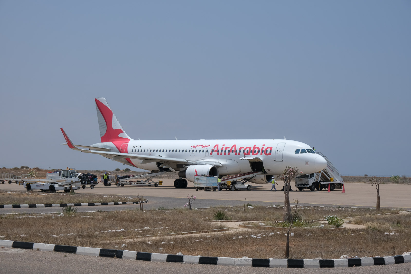
Air Arabia operates direct flights from Abu Dhabi on specific days of the week. Flights from Cairo are also possible, typically routing through Aden, on mainland Yemen, though layovers can stretch beyond nine hours depending on the flight schedule. In 2025, the only way to secure a seat on either route was through a local tour operator.
2026 update: since January 2026, the flights previously operated from Abu Dhabi seem to have been suspended. Socotra is now accessible via a weekly direct flight on Tuesdays from Jeddah, Saudi Arabia, operated by Yemenia Airways.
My plans to reach Socotra in 2025 nearly fell through when I was told back in November that the twice-weekly flights for the month of March were fully booked. Luckily, in January, I received a text from a local operator I'd been in touch with: a third weekly flight had been added on Fridays. Just like that, the trip was back on.
There was a dedicated check-in counter at the airport in Abu Dhabi for flights to Socotra, which made the process fairly straightforward. That said, the seat printed on your ticket isn’t always the one you’ll end up with on the plane. I had been assigned a window seat, which I was especially looking forward to in order to glimpse the island from the air, but when I boarded, someone else was already sitting there. A bit of polite negotiating followed, which created quite a reshuffle as it turned out that neither of the other passengers in the row were in their assigned seats either. I guess I got lucky - the flight attendant mentioned she was surprised they even entertained my proposition!
I ended up on the right-hand side of the plane, but for the best views of the island on arrival, I’d recommend aiming for the left. It’s absolutely worth securing that window seat.
Weather
We traveled to the island at the tail end of the dry season, in late March. It had been a particularly dry year, so much of the greenery had completely faded to brown, but in exchange we generally had uninterrupted blue skies!
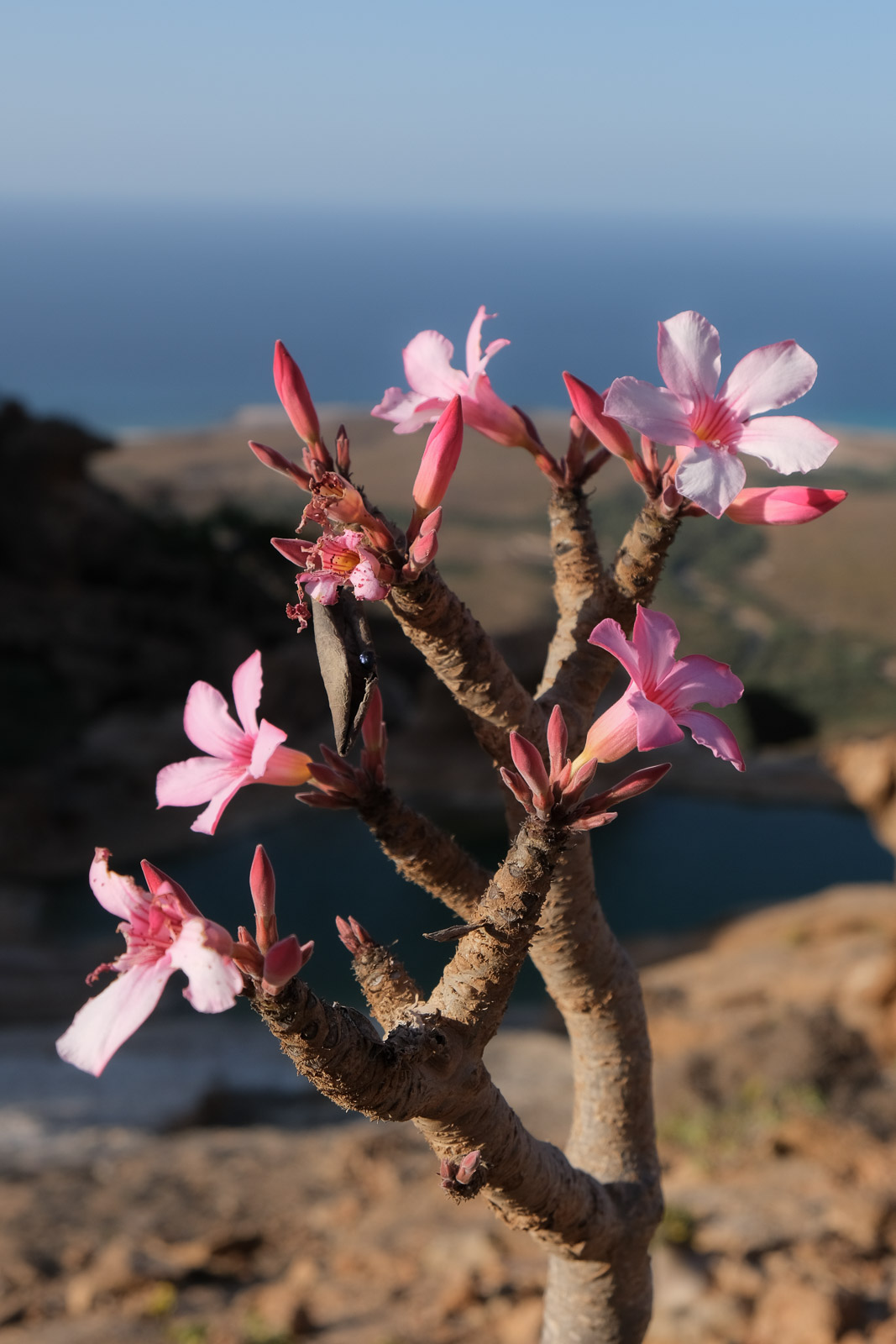
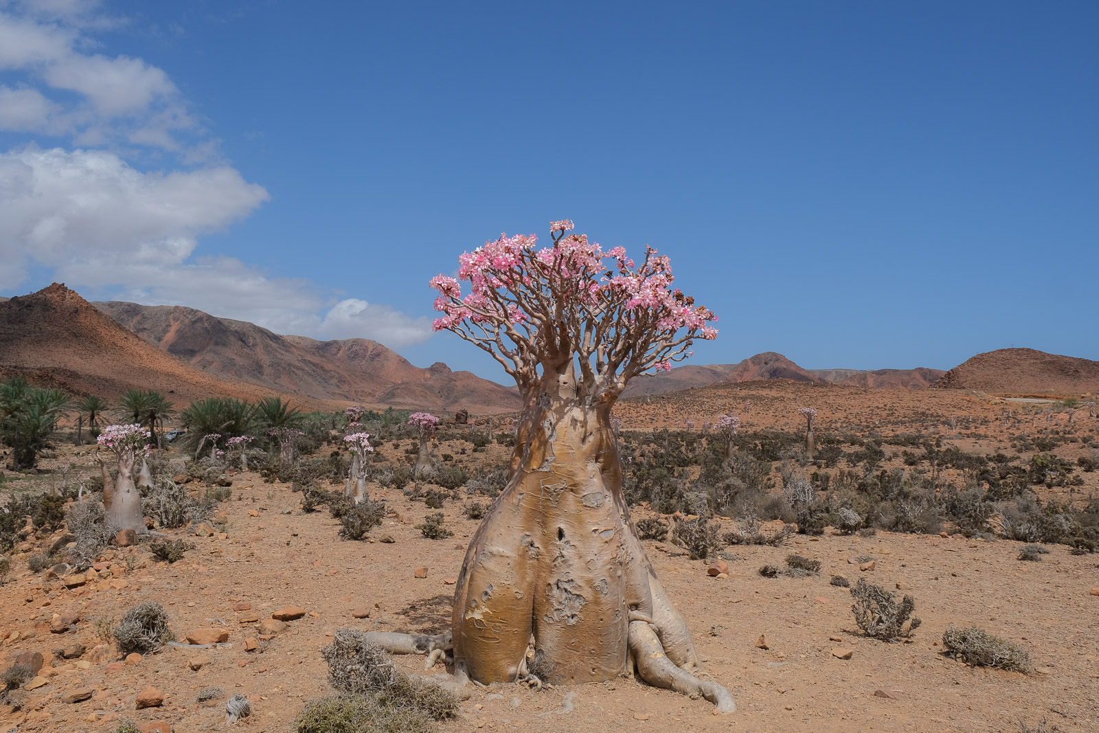
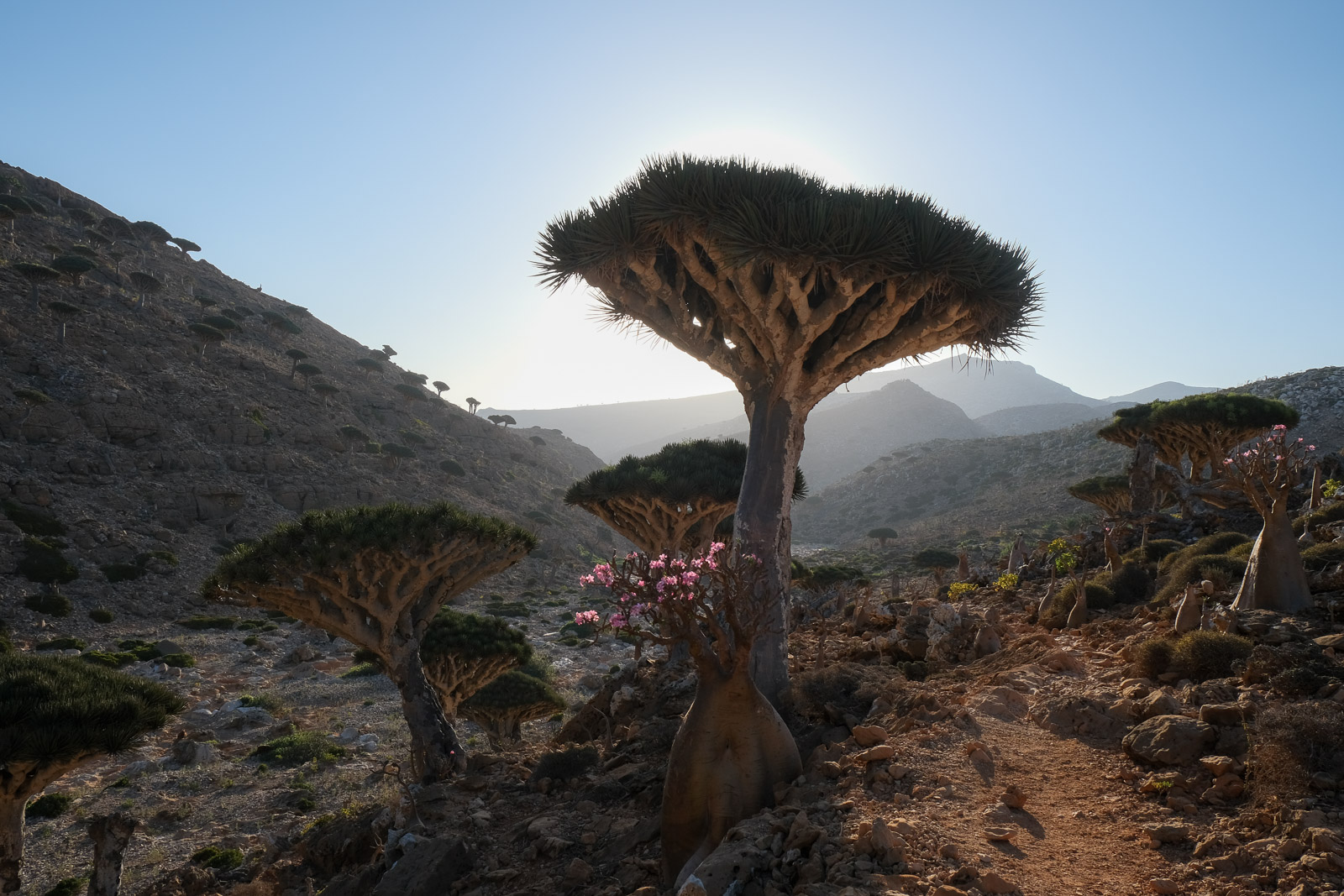
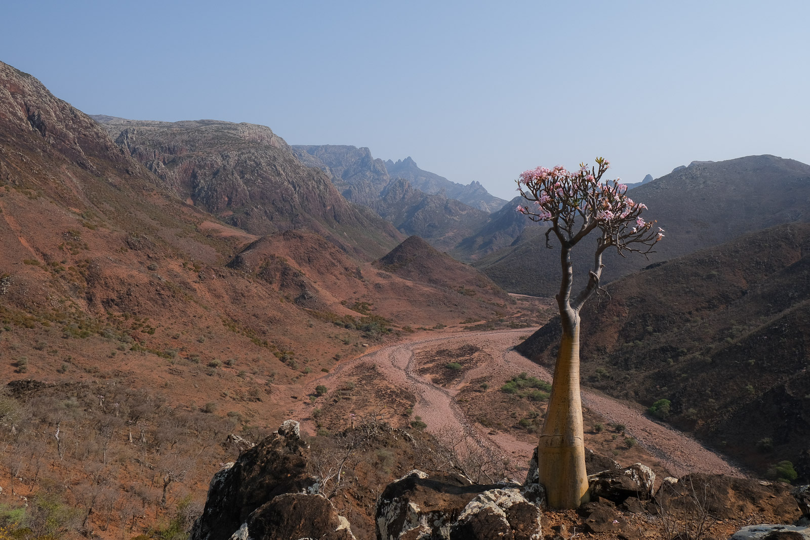
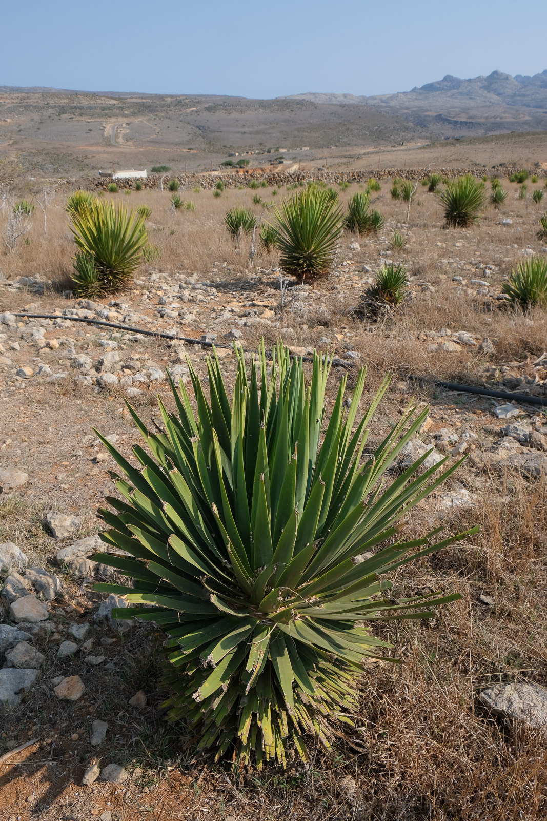
There are two main seasons generally recommended for visiting Socotra: February-March marks the end of the monsoon season, when the weather is dry and relatively cool, ideal for hiking, and the greenery from the rains has not fully faded. March, in particular, is known for the blooming of the island's bottle trees, which are covered in soft pink flowers. Although our visit at the end of March was quite dry, we were still fortunate to catch the end of the blooming season. As April approaches, temperatures begin to rise and dusty winds become more frequent, giving the island a more arid, hazy atmosphere.
October-November, on the other hand, signals the start of the monsoon season. Rain becomes more frequent, but the island transforms as landscapes turn lush and vibrant. It is an especially beautiful time for trekking. By late November, however, cyclones begin to become a possibility.
Tour operators
Most people visiting Socotra currently travel through organized tours, but the style of the trip can vary quite a bit depending on the company.
Almost all tourism on Socotra currently revolves around adventure-style camping expeditions: sleeping in tents each night, eating meals prepared outdoors, and travelling by 4x4 along rough dirt tracks to reach the island’s different regions and points of interest.
At the same time, a growing number of operators are beginning to market more comfort-oriented camping experiences, offering larger mattresses, furnished camp setups including portable showers and toilets, satellite internet, generators, upgraded equipment, and additional logistical support. These trips often come at a significant premium, and keep in mind that you will still end up camping in the same designated areas as the more budget-oriented tours. Another difference between the companies seemed to be the overall pacing of the trip and the quality and variety of the meals being prepared.
There is also the option of booking through international third-party agencies, which generally partner with operators on the island. While this can provide additional reassurance and easier communication during the booking process, it usually comes at a considerably higher price for what is often a very similar experience once on the ground.
After many weeks of research, we ultimately chose to travel with Socotra Trek Tours, largely because I was specifically looking for a company that was 100% locally owned while still offering reasonable pricing for a private trip that I could customize. Finding fully locally operated companies turned out to be more difficult than I had expected, as many tours are marketed internationally through outside agencies or partnerships.
Another major reason we chose Socotra Trek Tours was that I was determined to include several days of trekking in the Hajhir Mountains, and they seemed especially knowledgeable about the different routes and logistics required to organize them.
Overall, we were very happy with the experience. The only thing I would note is that the food wasn’t necessarily exceptional, particularly at some of the larger campsites (Arher Beach, Firmihin Forest, and Detwah Lagoon), where meals sometimes felt like a mix of what nearby groups were having. That said, we were always extremely well fed, and realistically, we hadn’t come to Socotra for the culinary experience. I also felt that, had I not done a fair amount of research beforehand, the itinerary might not have been as tailored to our interests. For example, I didn’t realize that camping on Shu’ab was even an option, and it wasn’t something that was suggested to us - even though our guides knew I was hoping for more remote campsites and wanted to reach the beach before the crowds.
We booked directly with the owner, Adnan, through WhatsApp (+967 777 948 334), which also made organizing and customizing the itinerary relatively straightforward.
Political situation
Socotra is part of Yemen, but the island's political situation is somewhat distinct from the mainland. While Yemen has been affected by ongoing conflict, Socotra remains relatively calm and removed from the violence.
In recent years, influence on the island has shifted. A southern separatist group, known as the Southern Transitional Council, backed by the United Arab Emirates (UAE) plays a visible role on the island: funding infrastructure, supporting humanitarian projects, and maintaining a kind of security presence. The UAE's influence has therefore increased, even though Socotra is still officially under Yemeni sovereignty.
During our time on the island, we also saw a few Saudi flags. While Saudi Arabia has had a limited presence on the island, largely tied to mediation and support for Yemen’s central government. its role remains far less visible than that of the UAE.
Although nothing is officially confirmed, our guide did point out a few coastal areas that were, according to him, becoming privately controlled. It’s hard to know exactly what that means in practice, but it did raise questions about how things might evolve. Personally, I wouldn’t be surprised if, over time, more formal tourism infrastructure begins to appear (for example, all-inclusive style hotels). That said, Socotra is a designated UNESCO World Heritage Site, which offers a level of protection and, hopefully, will help preserve the island's landscapes and endemic biodiversity.
At the same time, the current tourism model, which mostly revolves around camping, already feels, at least to me, close to its limits. Not necessarily in terms of space, but in terms of infrastructure, particularly waste management. Facilities on the island remain very basic, and systems for handling waste and protecting fragile ecosystems are still developing. With the number of flights and visitors gradually increasing each year, it does raise some concerns.
Hadiboh
Hadiboh, often referred to as the island's capital, is small and mostly serves as the administrative and logistical hub of the island. It's where you can find the airport, supply shops, and the few guesthouses that exist on the island. We didn't spend much time there as we met our guide (Faisal) and driver (Abu Sultan) directly at the airport before setting off in the direction of Homhil Protected Area.
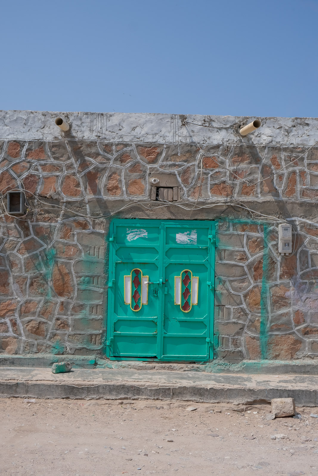
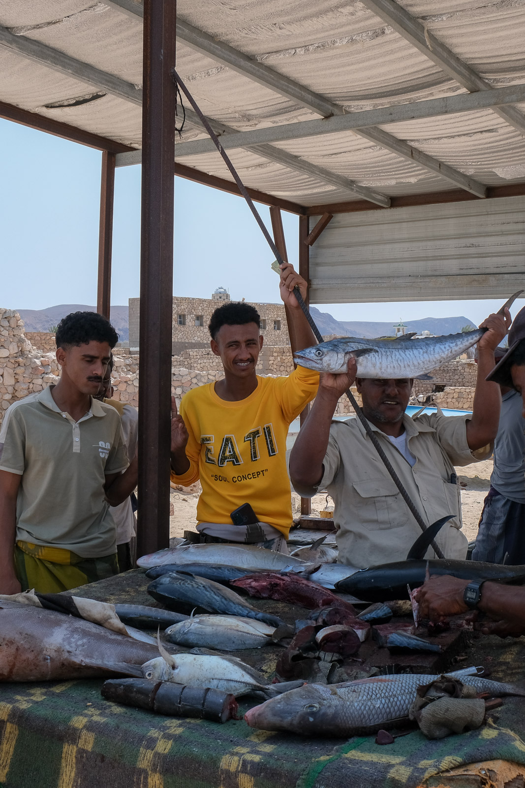
That being said, if time had allowed, I would have loved to take a stroll through the city, as I’m sure it would have offered a completely different side of Hadiboh through its spice markets, fish markets, and everyday street life. I had also been told about a local artisan known for crafting beautifully ornate colourful doors, something I would have loved to see in person.
As it was the first day of Eid al-Fitr, a multi-day celebration marking the end of Ramadan, centered around family visits, shared meals, and communal prayer, Abu Sultan asked if we would mind stopping by his family home so he could enjoy one last meal with his family before beginning our seven day adventure. Of course, we said yes. I was excited for the chance to catch a glimpse of daily local life on the island.
Within minutes of setting off, it was already clear that the landscapes on this trip would not cease to impress me. The terrain was dry, but I could see that the mountains in the distance still held on to hints of green. I also could not get over the intensity of the blue along the coastline, it almost seemed to glow.
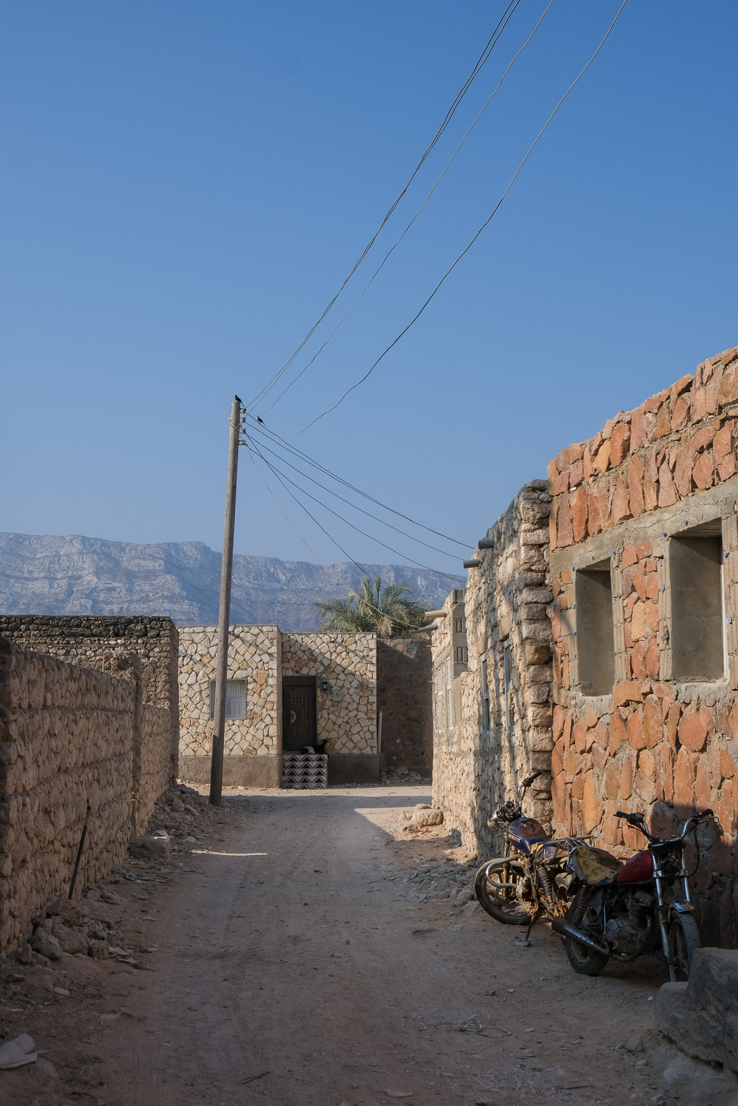
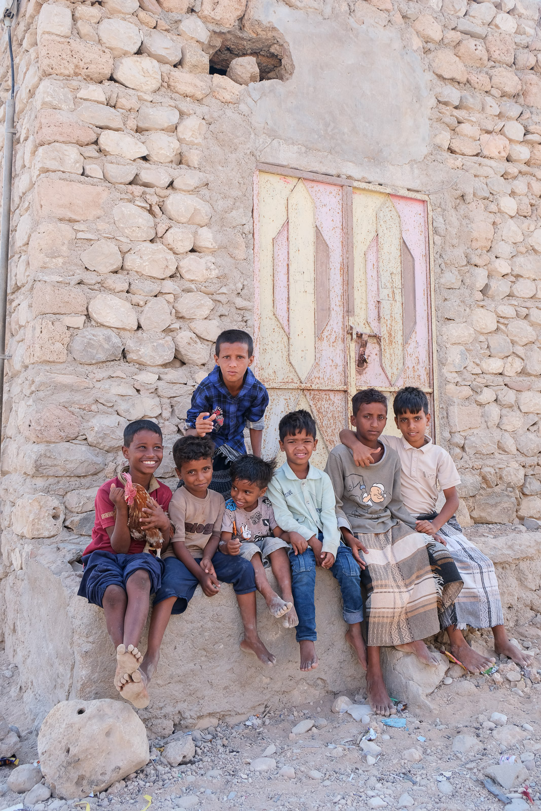
Within seconds of arriving at Abu Sultan's home, we were greeted by at least five of his children (at the time, his wife was pregnant with their eleventh). Most traditional homes on the island are simple, single-story structures built from locally available materials such as stone, mud, and coral rock, with flat roofs designed to withstand the hot, dry climate.
I somehow ended up being guided into one of the rooms and invited to sit on the dirt floor. The girls and the youngest boys gathered around me, sitting close, staring at me with quiet curiosity. My boyfriend, who speaks Arabic, peeped his head in to let me know that in Socotri culture men and women eat separately, so I was to stay with the women and the younger children, none of whom spoke a word of English. While the main local language is Socotri, Arabic is also commonly spoken. Unfortunately, in 2025 my own Arabic vocabulary was extremely limited.
After about ten minutes of attempted communication, I gave up and pulled out a set of colouring pens which I handed to the children. With no paper available (how could I have not thought to bring any!), they quickly began drawing on their own skin instead. We spent the next little while mostly drawing and smiling at each other in silence.
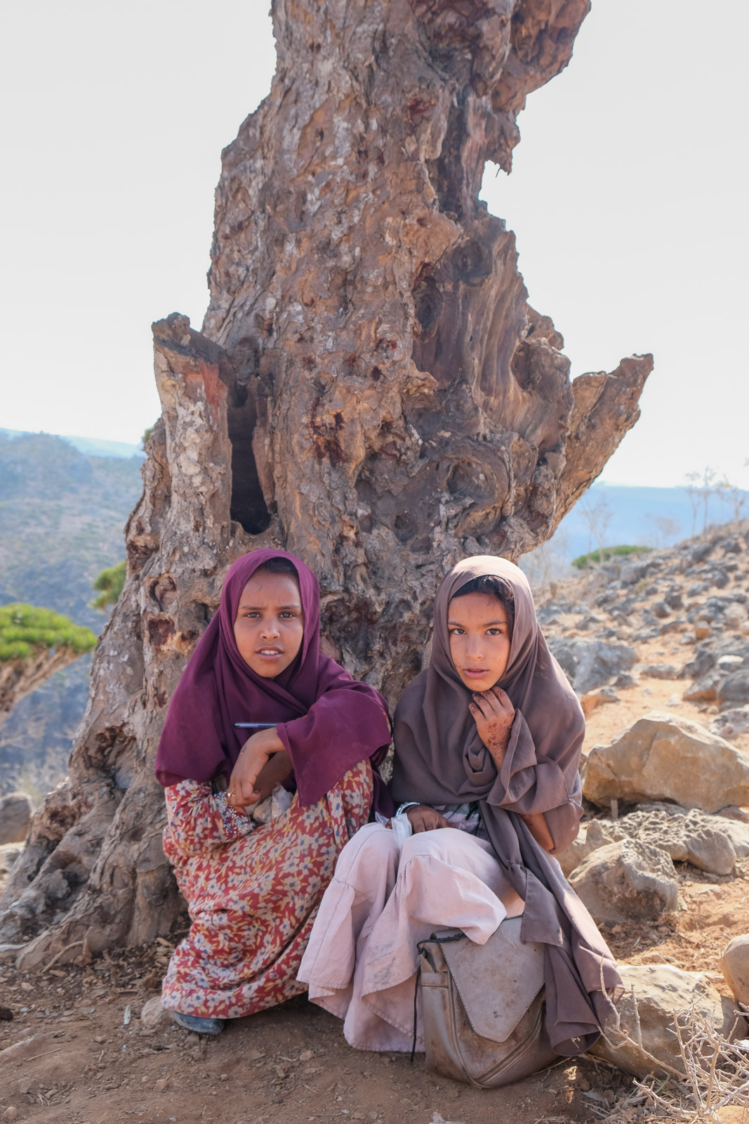
At one point, I tried asking who in the family had done the henna designs on their hands, which looked fresh and likely done specially for Eid al-Fitr. One of the girls suddenly jumped up excitedly, returning a few moments later with several stencils and what looked like a dark paste made of mud. Before I could react, they began placing the stencils on my feet, hands, and legs, covering them with the mixture. I realized she had thought I was asking for henna. I managed with gestures to negotiate it down to about six stencils, or maybe it was less my negotiating skills and rather the large communal plate of spiced rice topped with pieces of roasted goat that arrived. Everyone ate from the same plate with their hands, and so did I; it was simple, but incredibly delicious.
I don’t think I’ll ever forget the reaction when I walked back out to where our vehicle was parked, my hands and feet covered in clay. Everyone burst into laughter, and I was immediately given a new name: “Halima,” meaning patient in Arabic. It stayed with me for the rest of the trip.
Homhil Protected Area
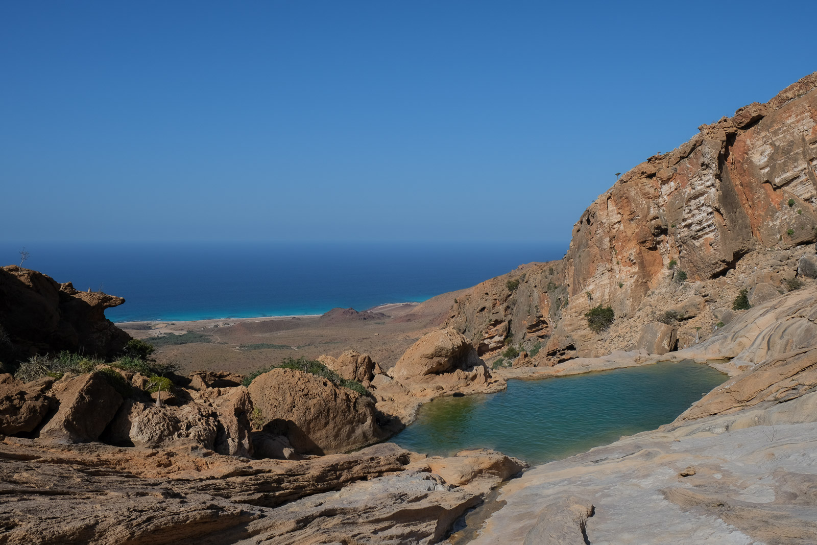
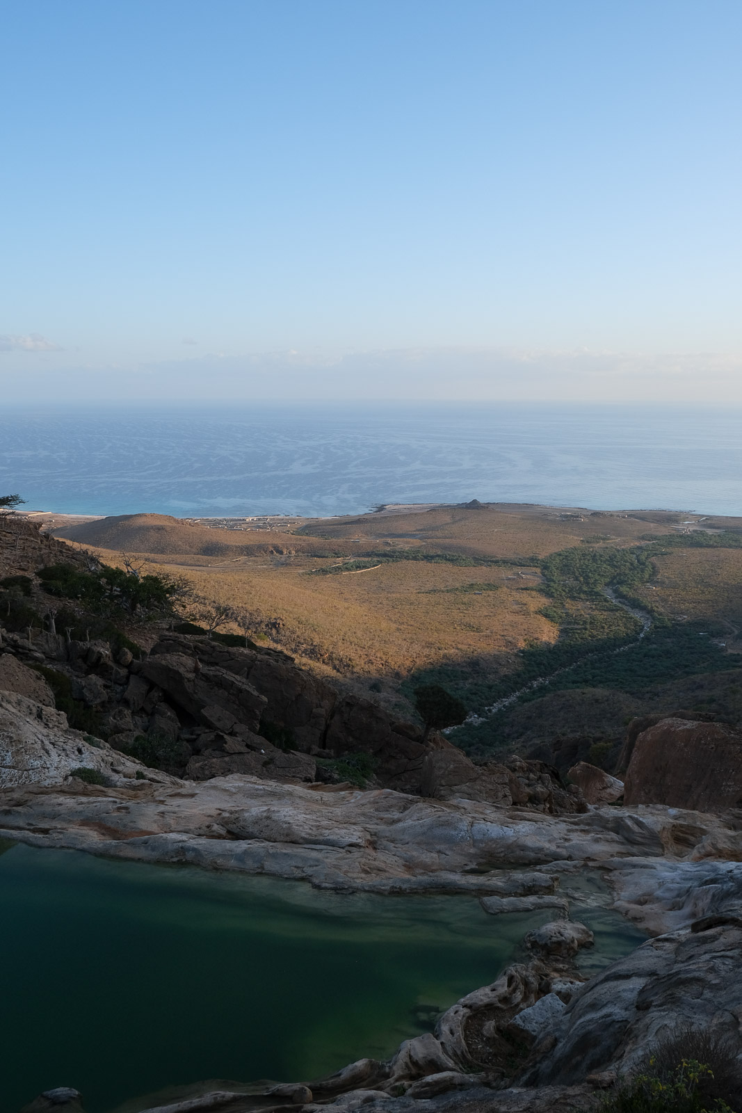
Homhil Protected Area is a highland plateau perched above the island's northern coastline. Its most iconic feature is a natural freshwater infinity pool, set along the edge of the cliffs with sweeping views of the sea below. The 20 minute trail leading to the pool starts from the small designated campsite.
Along the way, the landscape is dotted with endemic plant life, including dragon's blood, frankincense and bottle trees. A network of smaller trails also winds across the plateau, offering quiet vantage points that are especially beautiful at sunset and ideal for stargazing under clear skies.
After a full day of travel, it felt incredible to slip into the cool water and take in the view. We lingered for a while, then stretched out in the sun, slowly letting it sink in - we had made it, we were in Socotra.
Back at camp, we were served our very first camping meal prepared by our guides: spaghetti with tomato sauce, roasted chicken, fresh tomatoes and, of course, what would quickly become a ritual at every meal: one large thermos of what I've been calling Bedouin tea since our trip to Jordan (black tea with sugar) and another of karak, a richer tea with goat's milk.
Later, we pulled out a two-player game we had purchased right before the trip: Splendor Dual. What followed was a long hour of squinting at the instructions in near darkness, trying to figure out the rules while Faisal and Abu Sultan chatted away nearby. I highly recommend it, and it doesn't take much space in a backpack.
The next morning, I was up at sunrise, making my way back to the infinity pool to see it in a different light. I sat on the rocks and watched as the sun slowly spilled across the landscape, everything still and quiet.
The night before, I had told Faisal I was hoping to leave early so we could reach Kalysan Canyon before the heat set in, and, ideally, have it to ourselves. So I have to admit I was a little surprised to return to camp and find the tents still standing and breakfast only just being prepared. It didn't take long to realize I would need to adjust to "Socotri time", where schedules are fluid, and time moves at its own pace. I think they may have realized that "Halima" wasn't the most fitting nickname for me after all...
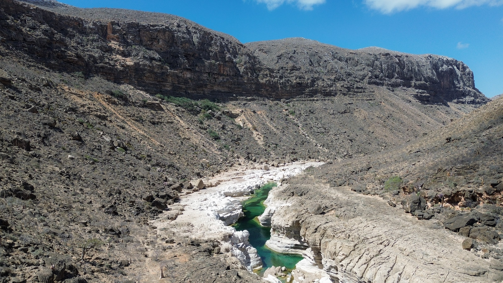
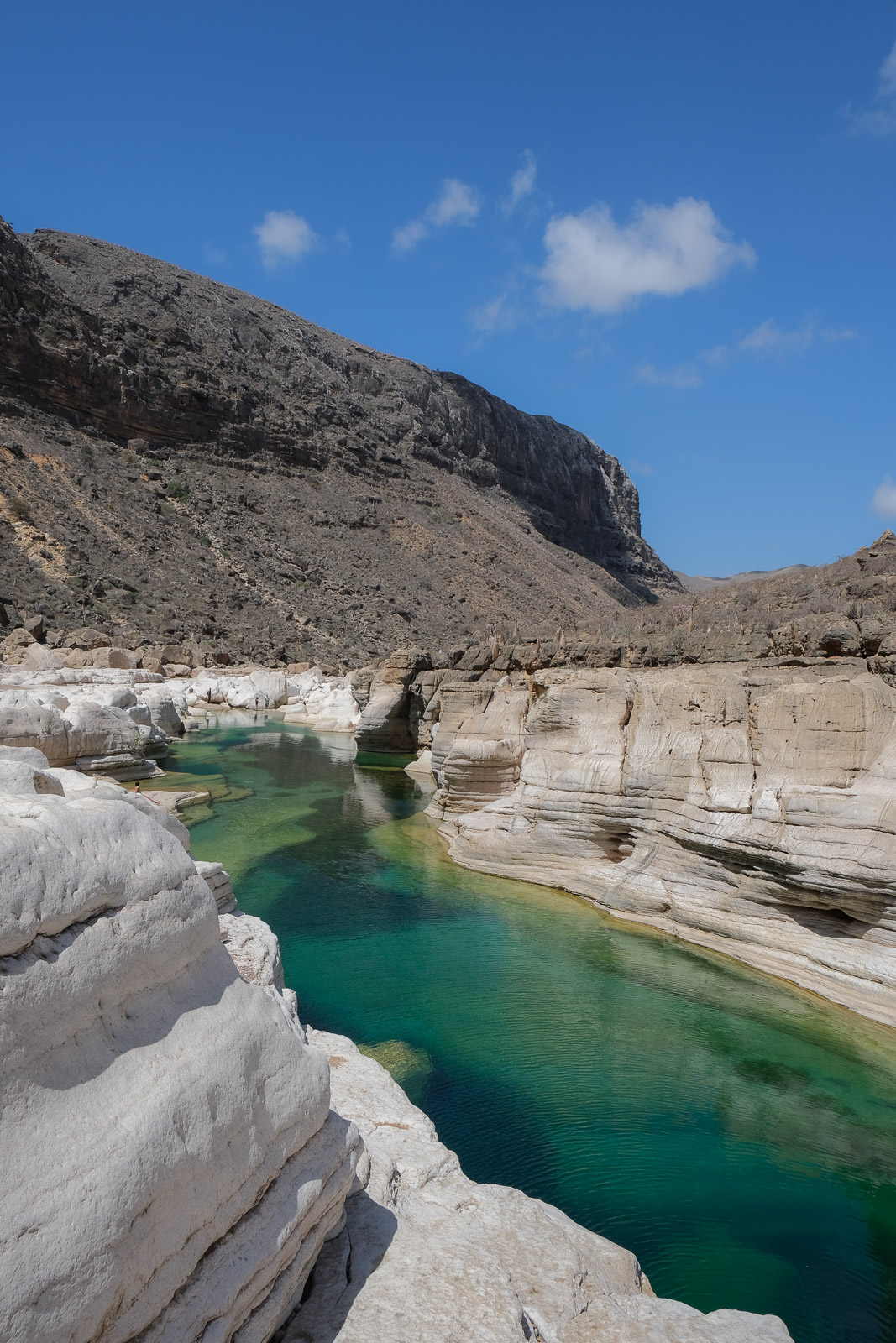
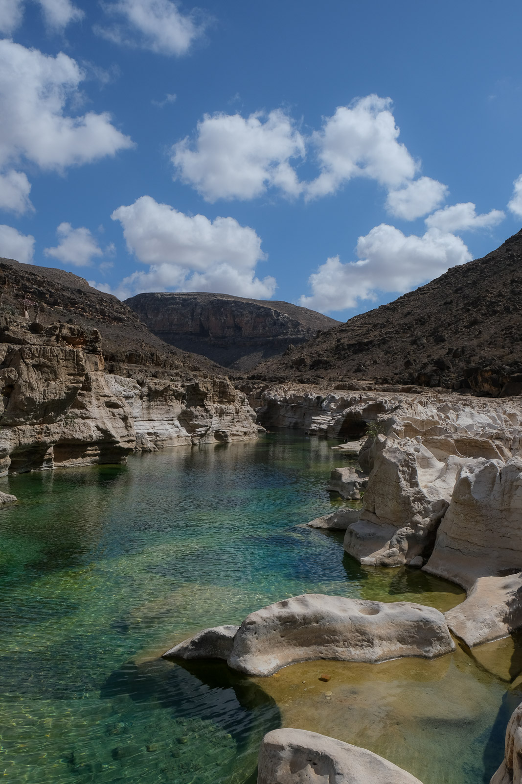
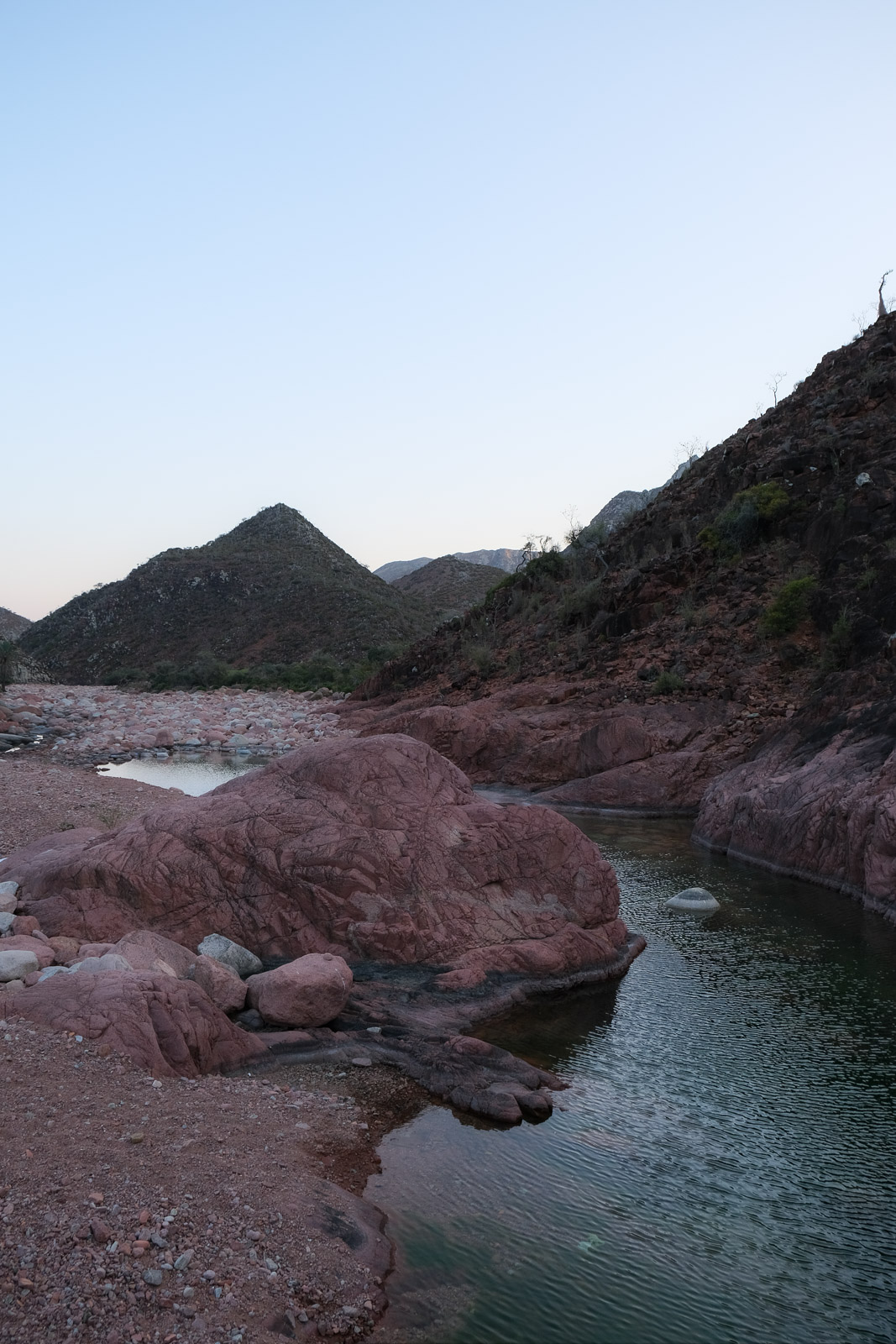
Kalysan Canyon
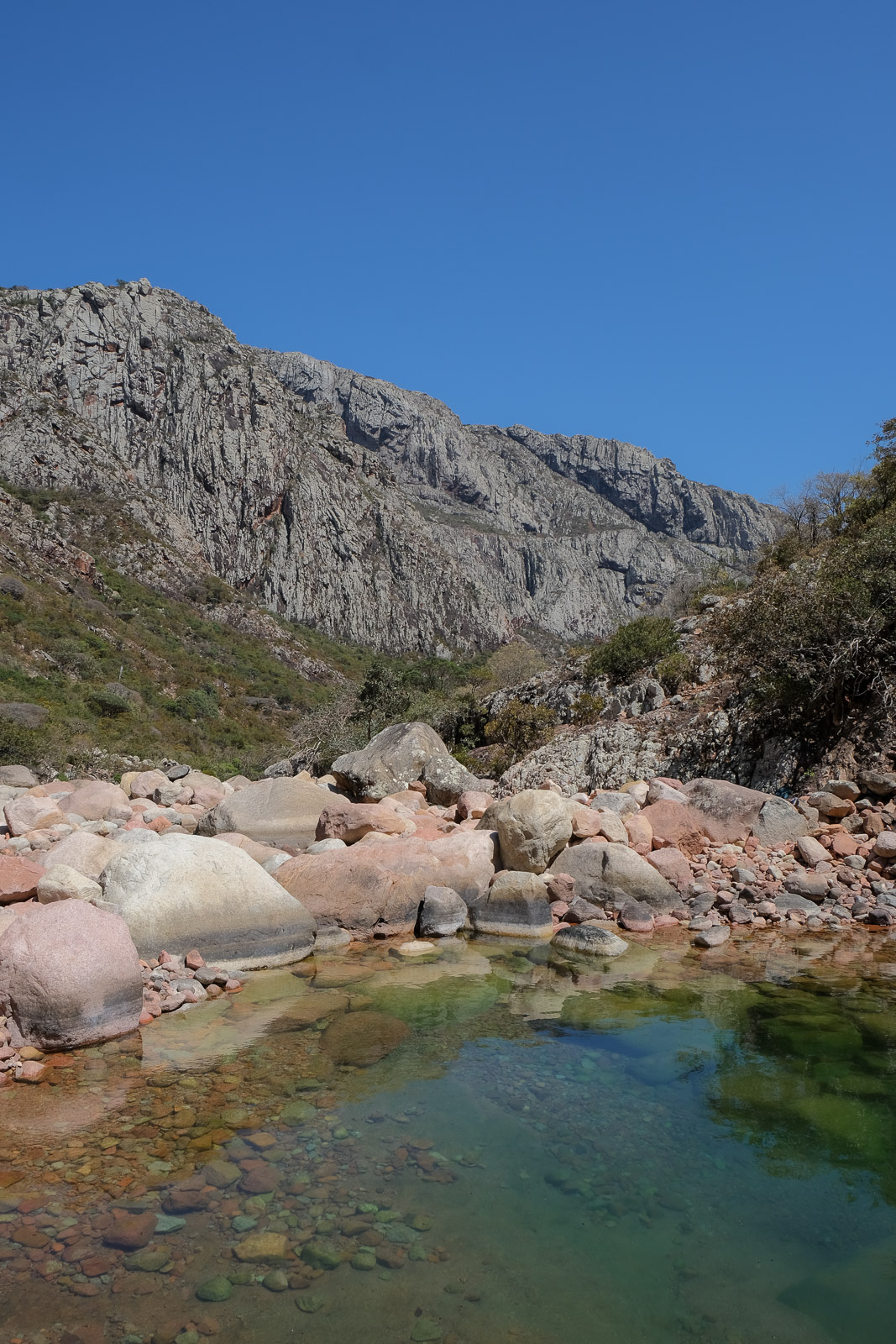
Kalysan Canyon felt hidden until we were standing right at its edge. The hike down was short, but uneven, following a rocky path that winds between boulders before opening into a narrow gorge carved into pale, almost white granite, where a clear freshwater pool glows in a beautiful deep teal colour. The water was incredibly inviting, almost perfectly temperate, offering just enough coolness to refresh without ever feeling cold. You can swim through the canyon for quite a while, moving between deeper sections until it narrows into a series of smaller pools and cascades.
What makes it especially striking is the contrast: above, the mountains remain dry and rugged, shaped by heat and wind, while below the blue ribbon of water cuts through the rock. During the rainy season, the transformation is said to be dramatic, with later levels rising and the surrounding slopes turning green.
As we explored the gorge, more groups began to arrive, and we were reminded that we weren't the only ones to be discovering this hidden gem. I was therefore especially glad that Faisal had (somewhat) listened to my request to arrive early. We enjoyed watching the local boys accompanying these groups leap off the cliffs in acrobatic jumps, as we sat nearby eating our packed breakfast - yes, I had insisted on bringing it with us so we could leave camp earlier.
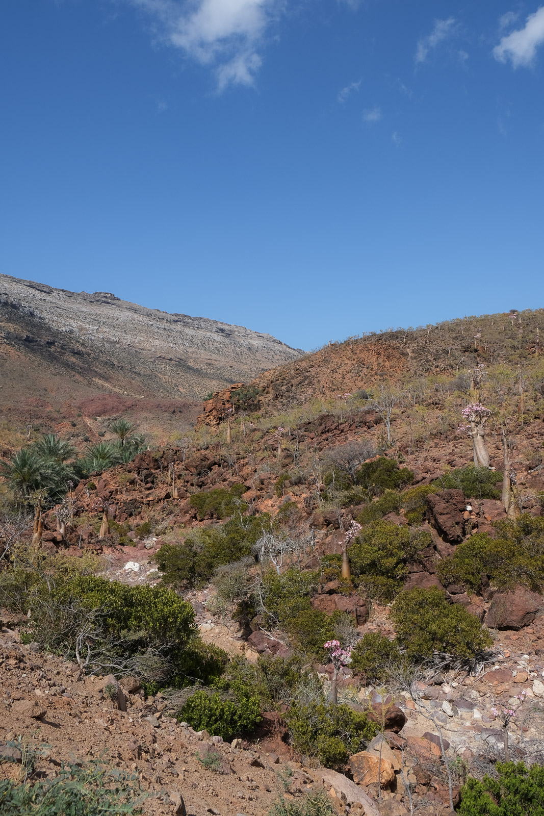
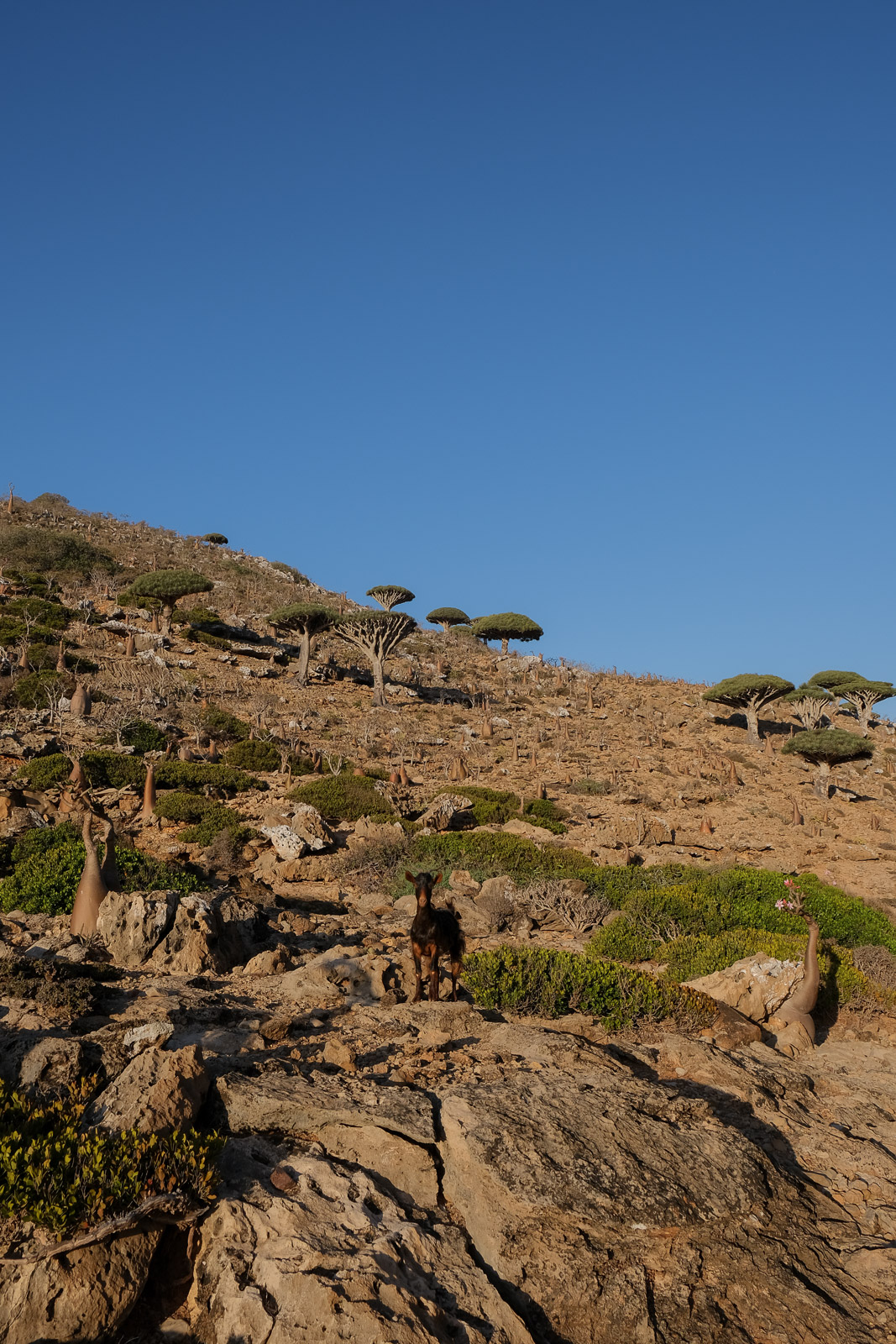
From the canyon, we continued toward Arher Beach, though we made a few stops along the way. The first was a field of blooming bottle trees not far from the roadside, their swollen trunks and soft pink flowers standing out against the otherwise dry landscape.
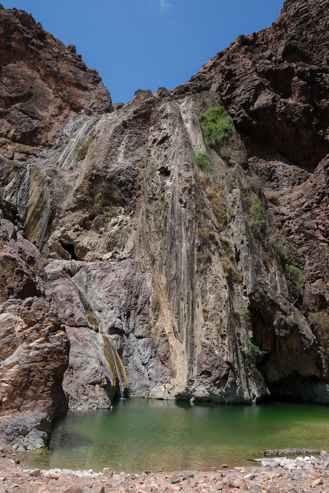
Earlier in the trip, I had told Faisal I would love for him to show me places I likely wouldn’t have discovered doing my own research. One of those stops was a small oasis tucked into the mountains where, during the rainy season, a waterfall is said to cascade down the cliffs. At the time of our visit, only a shallow pond remained, but it was still refreshing to find ourselves surrounded by greenery, and, of course, goats!
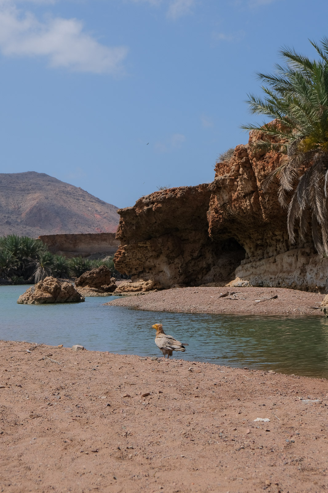
We later stopped for lunch at another larger oasis, though personally I would have preferred heading straight to Arher Beach to spend more time exploring the dunes and swimming in the sea. I have to admit I felt a little frustrated, as the lunch spot (which I think may have been Khor Quryah on Google Maps, though I could be mistaken) was crowded with other tour groups, and the sound of generators took away from the sense of remoteness I had been enjoying up until then. By the time we finally arrived at the beach, the sun was already beginning to disappear behind the cliffs.
The only silver lining, however, was getting the chance to photograph an Egyptian vulture while snacking on refreshing slices of watermelon.
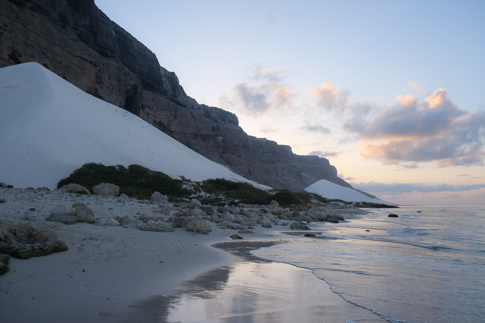
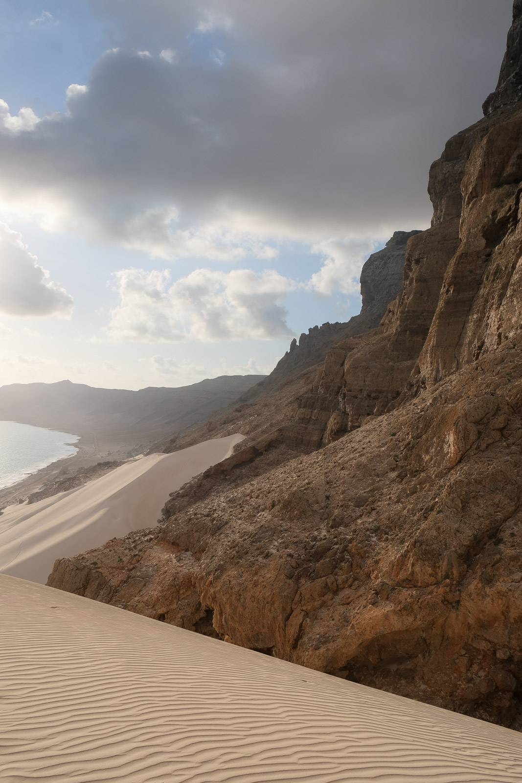
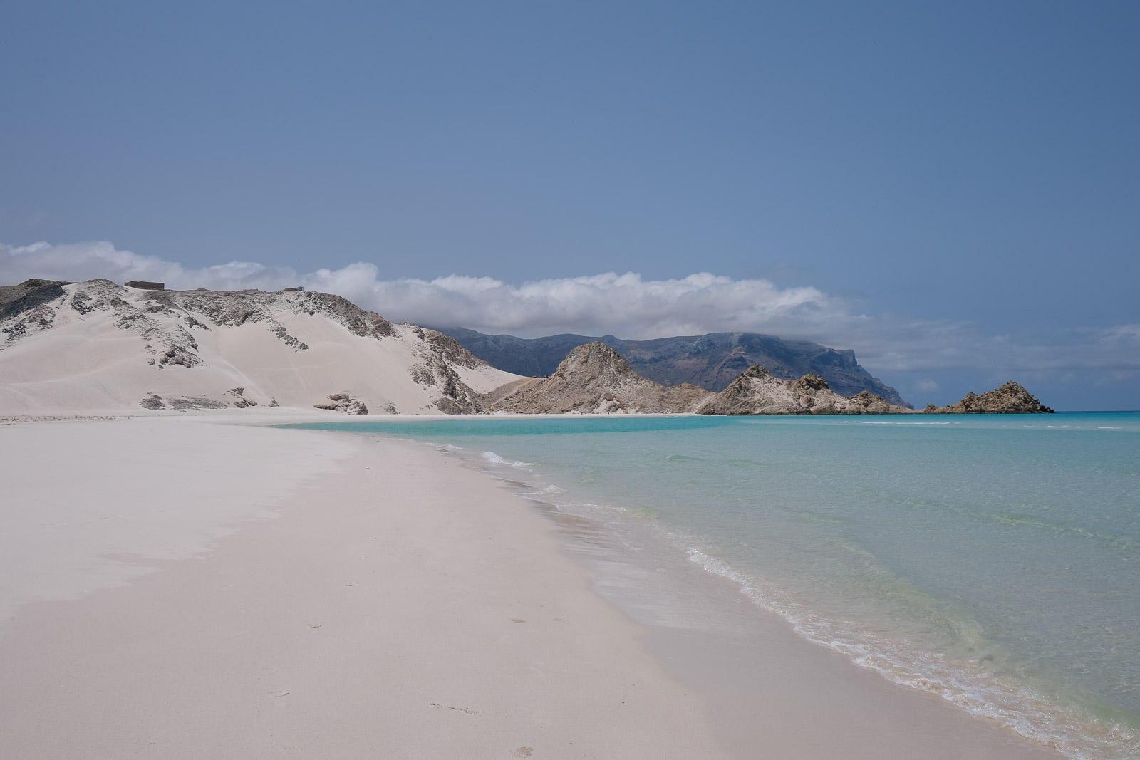
Arher Beach
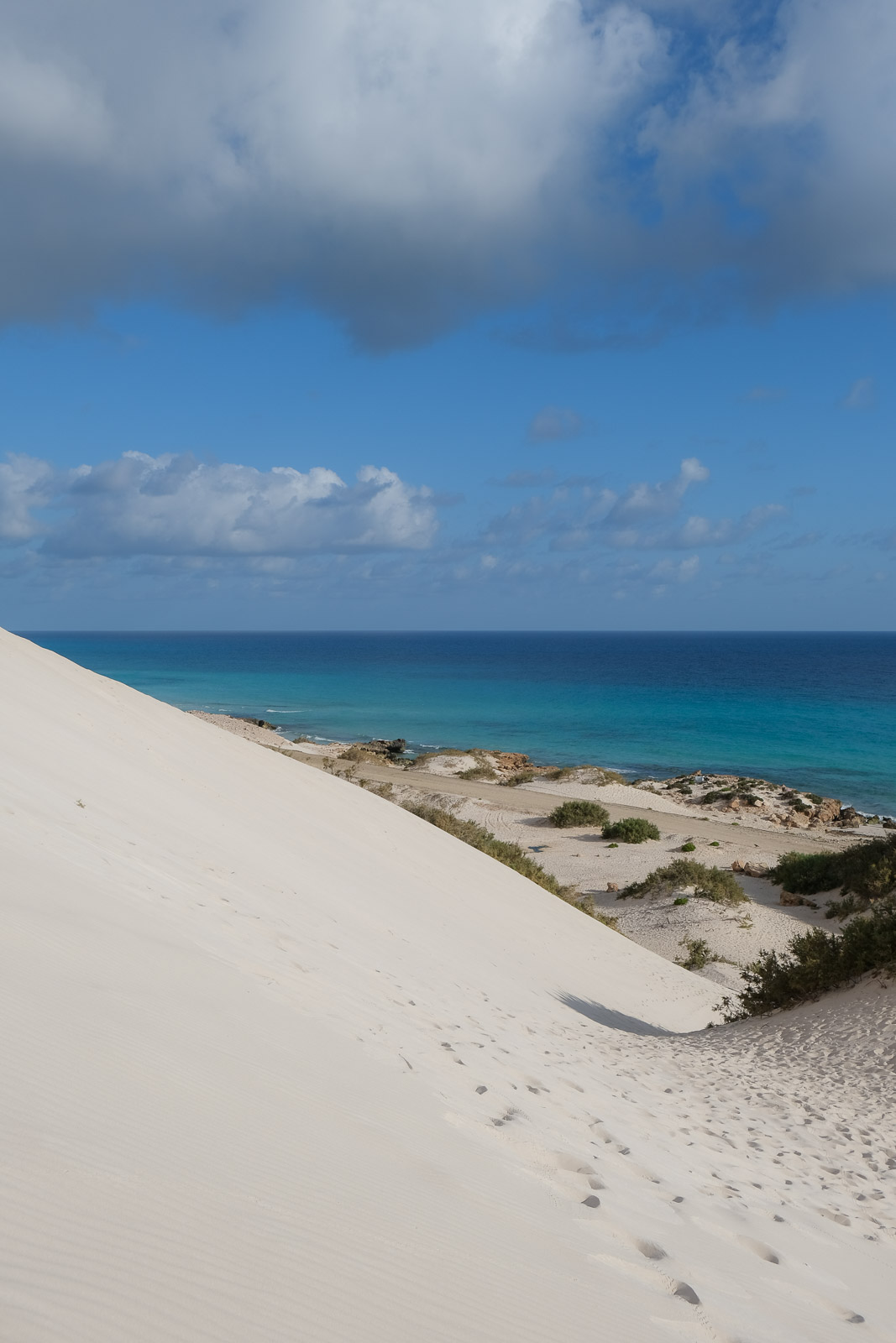
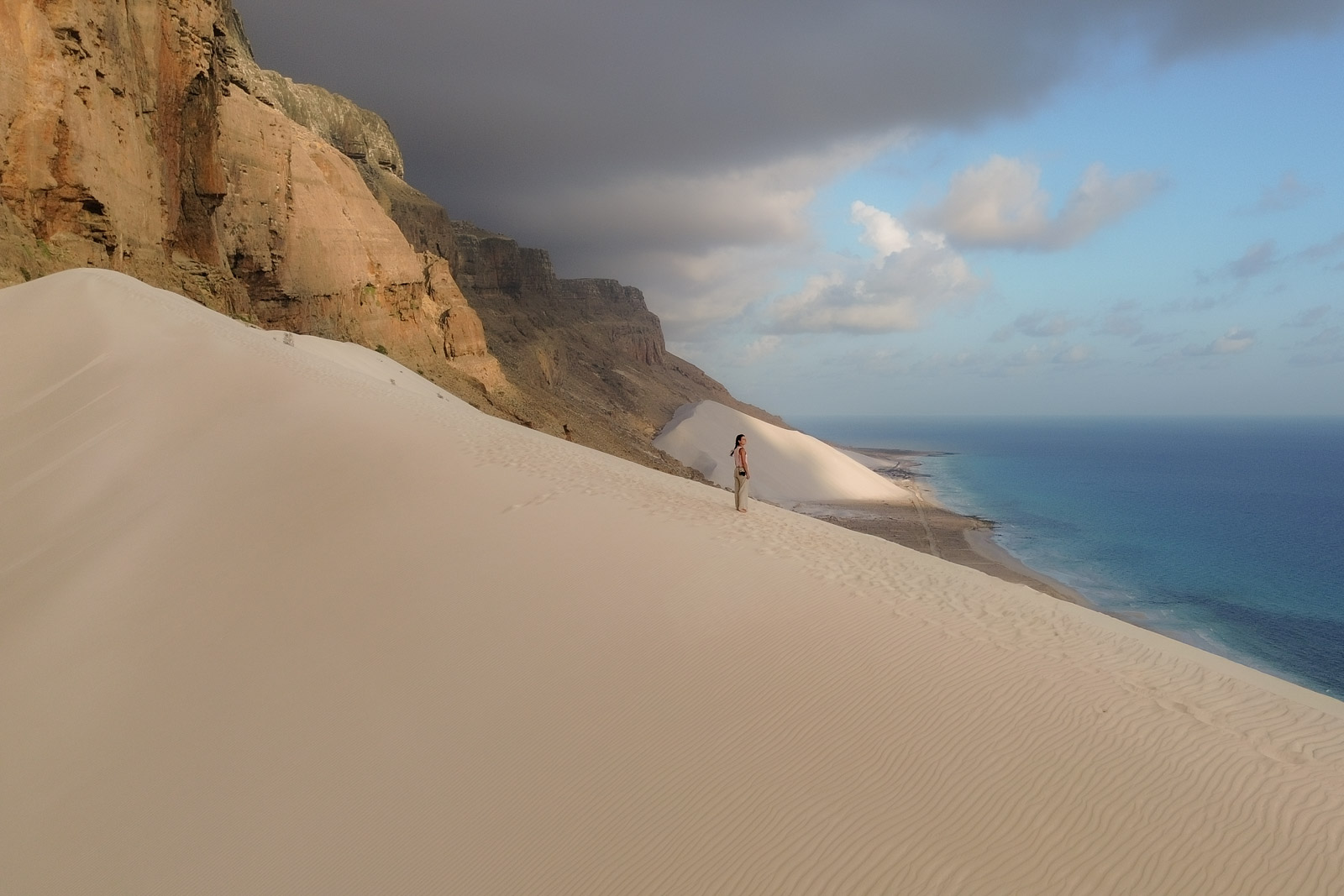
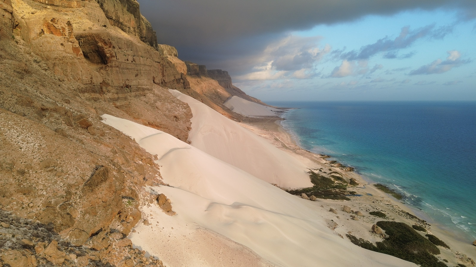
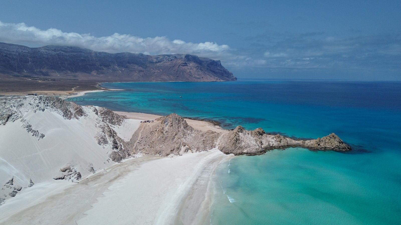
Arher Beach is one of the most dramatic landscapes on the island, where towering white sand dunes rise directly from the edge of the sea. Backed by steep cliffs and mountains, the contrast between the bright sand, turquoise water, and rugged rock formations feels almost unreal. Freshwater streams flowing down from the mountains meet the sea here as well, creating small pockets of green along the shoreline.
The dunes seem to stretch endlessly upward, shaped constantly by strong seasonal winds, and climbing them gives sweeping views over the coastline.
We set up camp by the sea, and almost immediately set off barefoot across the sand, hoping to reach the top of a dune before the sun disappeared behind the cliffs. It didn't take long to realize we had underestimated how exhausting it is to climb soft sand, but it didn't make it any less enjoyable - sinking into the warm sand with every step as the sea stretched out beside us.
"Shower time" turned out to be quite an experience. Faisal had mentioned there was freshwater access somewhere among the rocks by the sea. What he actually meant was a plastic pipe sticking out from between the rocks, pouring freshwater directly into the sea, likely as part of some irrigation system further inland. So there we were, squatting in seawater up to our knees, rinsing ourselves off under this improvised little stream while the waves rolled in around us. By the following morning, the tide had risen enough that the pipe was completely submerged.
Dinner that evening was fresh tuna cooked right in the fire, served with rice. As we ate, Faisal told us about all the seafood we would be enjoying once we reached the western coast of the island near Qalansiyah. We were already salivating at the thought of it. The rest of the evening was spent in our camping chairs facing the water, thermoses of black tea and karak beside us, listening to the sound of the waves as the last light faded from the sky. By then, Abu Sultan had also developed a habit of preparing a variation of Luqaimat: small round pieces of fried dough, slightly crispy on the outside and soft inside, some batches sweetened with sugar or syrup, and they were dangerously addictive.
There’s a dune at the eastern end of the beach that’s particularly popular for sunrise, and although Faisal had recommended it, we decided to make a second attempt at climbing the dune closest to our camp so we could enjoy the morning in solitude.
The climb was no easier the second time around. It was false summit after false summit, each ridge making us believe we had nearly reached the top, only for another steep stretch of sand to appear ahead of us. It was a genuine workout. Even though clouds obscured the beginning of the sunrise, the effort felt completely worth it once we finally made it to the top, leg muscles burning. The colours of the cliffs and water, the sweeping coastline, and the delicate patterns sculpted by the wind across the untouched dunes made the moment feel surreal.
As exhausting as the climb up had been, the run back down took only minutes. We practically flew down the soft sand before ending straight in the sea, rinsing off the fine layer of sand that had found its way absolutely everywhere.
My favourite meals in Socotra were usually the breakfasts, largely because of the fresh Socotri bread: fire baked flatbread.
Breakfast was always spread out picnic-style and usually included eggs, soft cheese triangles (similar to La vache qui rit), some type of fresh fruit, halawe (a sweet crumbly sesame based spread, found across the Middle East), jams, and, of course, our now-essential thermoses of black tea and karak. There was something about sitting outside in the morning light, almost always with a beautiful view, scooping up our food with the delicious flatbread.
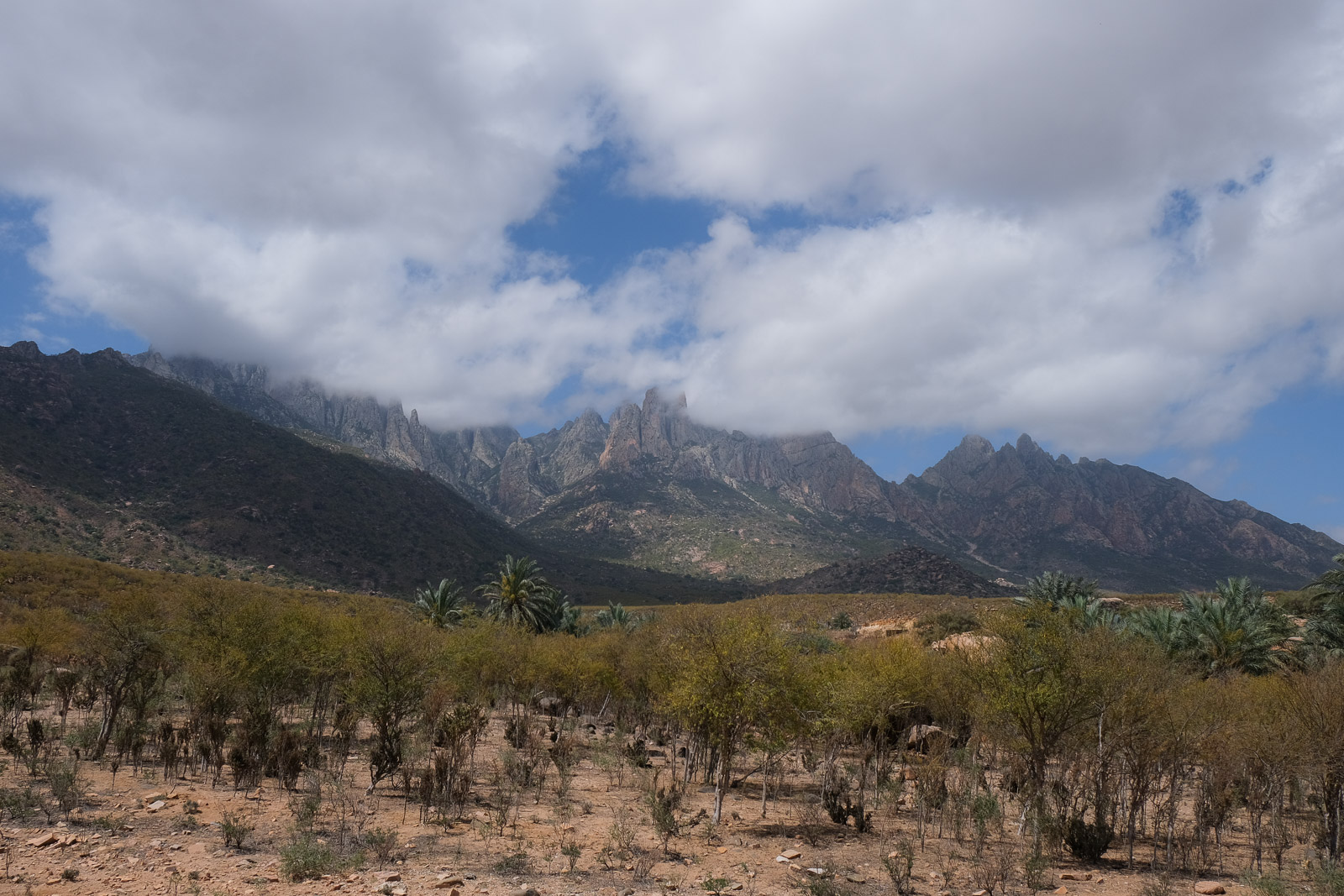
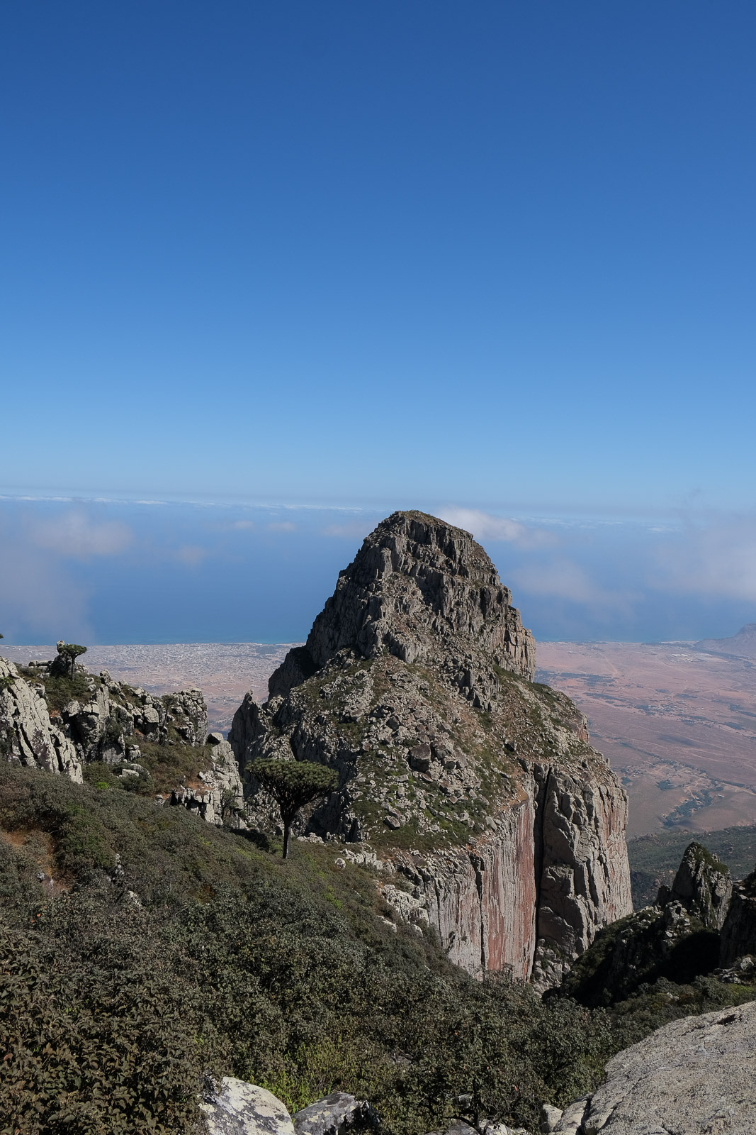
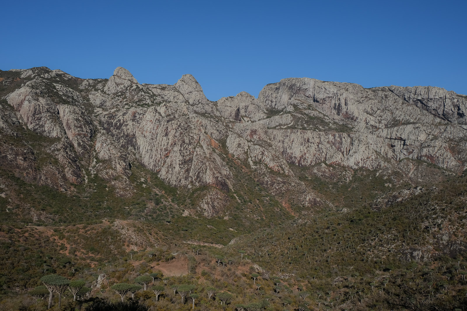
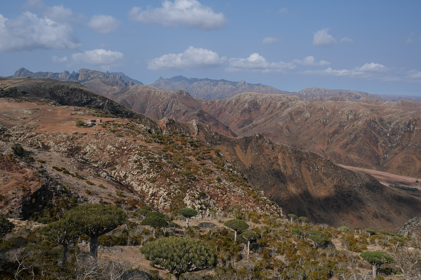
Hajhir Mountains
Right after breakfast, we were headed to the section of the trip I was most looking forward to: a three-day trek through the Hajhir Mountains. The Hajhir Mountains rise dramatically through the centre of the island and play an important role in shaping Socotra's unique climate. By trapping moisture and influencing rainfall patterns across the island, they help create the conditions that allow many of the endemic species, including the iconic dragon's blood trees, to survive in an otherwise arid environment.
Trek Day 1: Hadiboh - Ado Dimalah
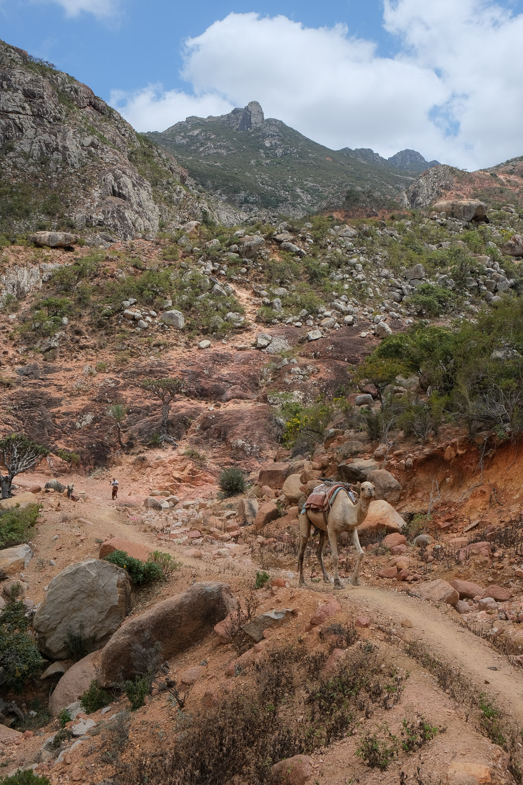
After stopping for some supplies at a small shop near Habidoh, we were off to meet our trekking guide, Abdullah, and the camel that would be carrying our equipment for the next three days.
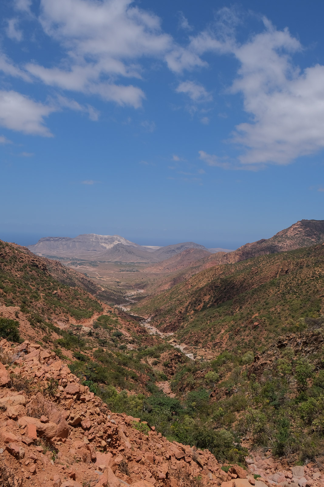
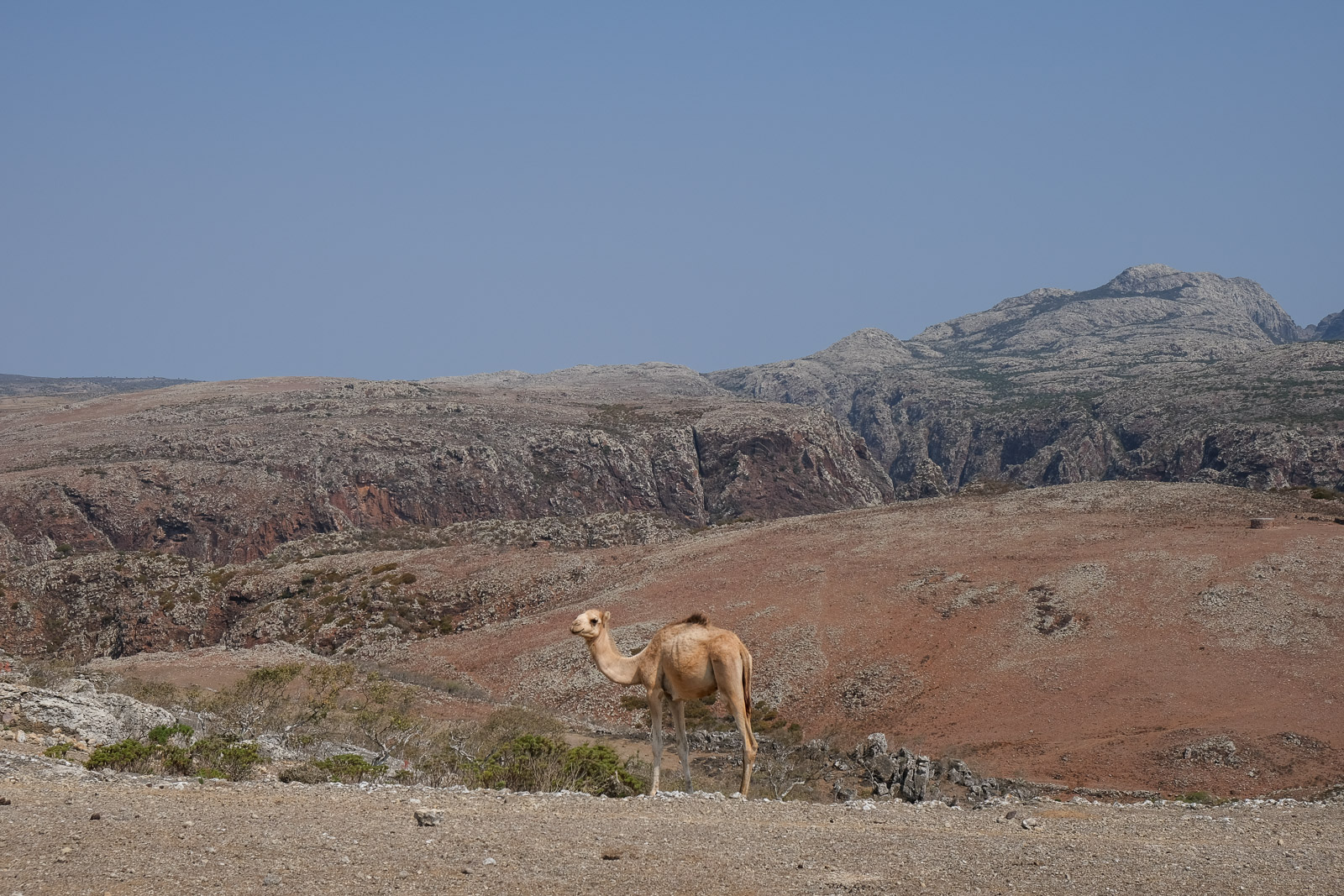
The first part of the trek followed a dirt road that gradually climbed the mountainside, with views over the Arabian Sea opening up as we slowly made our way higher and deeper into the rugged landscapes of the Hajhir Mountains.
We didn’t encounter any other tourists on the ascent, but we did cross paths with a man chasing after a camel that clearly had its own plans for the day, as well as a couple of men descending from the mountains with baby goats cradled in their arms. My first thought was simply how cute they looked, until it dawned on me that, given the timing of Eid, they were most likely being brought down for a family celebration dinner...
After about three hours of hiking, we stopped for lunch beside the trail near a small freshwater pool where we could cool off. While we had the option to fully plunge into the water, I was perfectly content simply sitting with my feet submerged. A well-earned break beneath the intense midday sun.
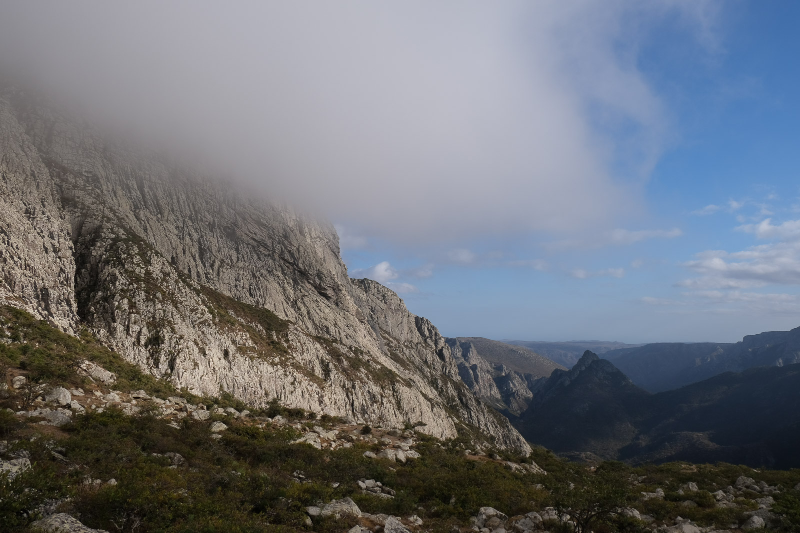
Like most of our meals on the island, lunch was cooked right on the spot, which meant the break stretched on for nearly two hours. Unfortunately, this also gave the clouds enough time to roll in. Predictably, my mood dropped, as it is often influenced by weather and the absence of clear skies.
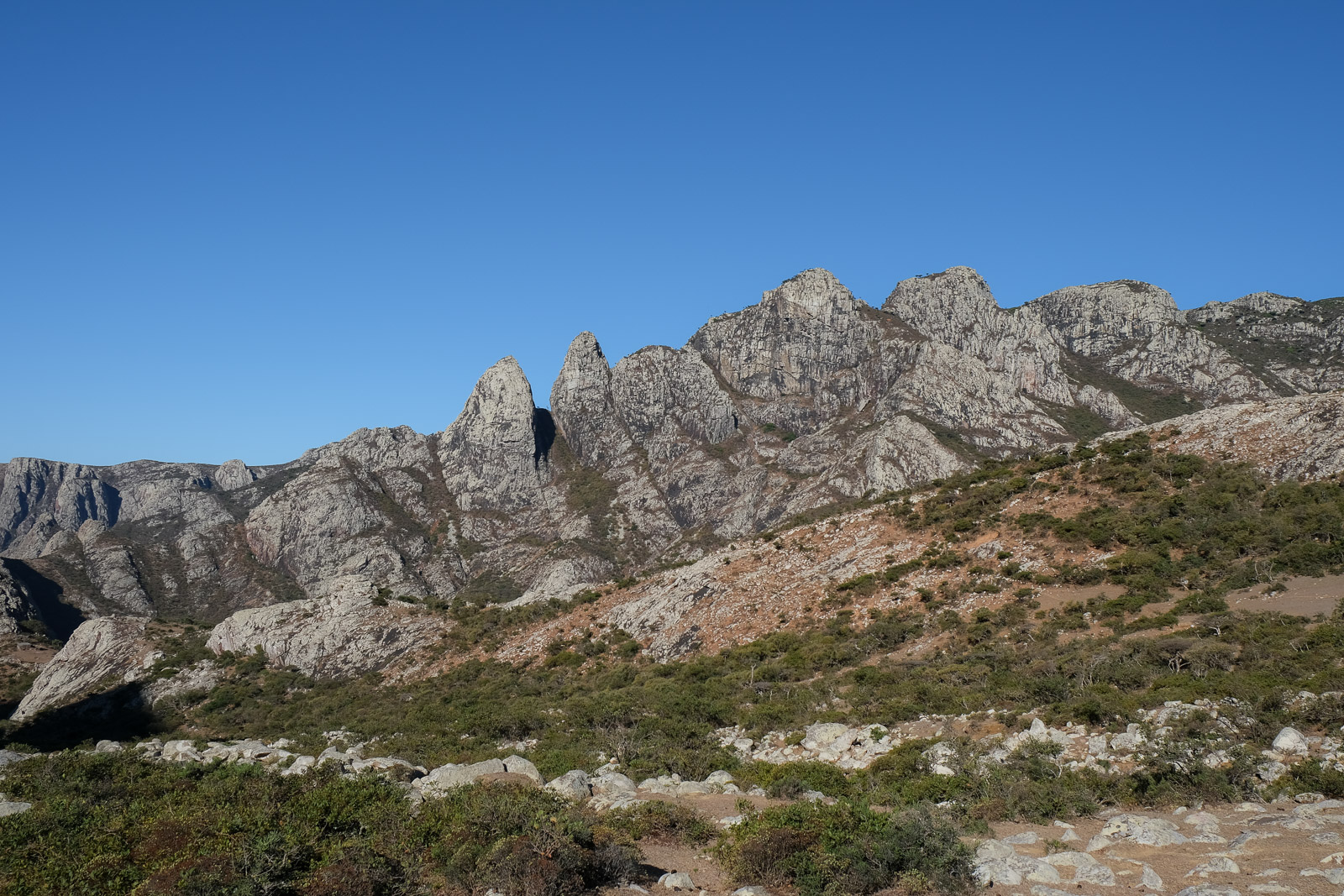
I had gone into this trek with almost no expectations. Despite trying to research the route beforehand, I had found very little information and almost no photos of the landscapes along the trail. So as we tackled the final stretch of the climb, I found myself growing increasingly frustrated by the clouds, mostly because I had no idea what they might be concealing from view.
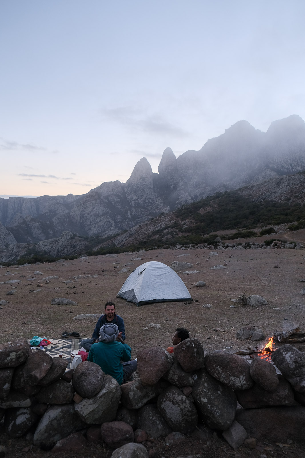
Thankfully, the moment we reached the top, I saw that as the clouds drifted over the ridge, they would thin and dissipate, leaving the valley below fully revealed. Even better, rather than taking away from the landscape, What remained of the clouds actually added to the atmosphere. I found myself completely overwhelmed by the view, running from one vantage point to another, taking photo after photo, unsuccessfully trying to capture what it actually felt like to be standing there.
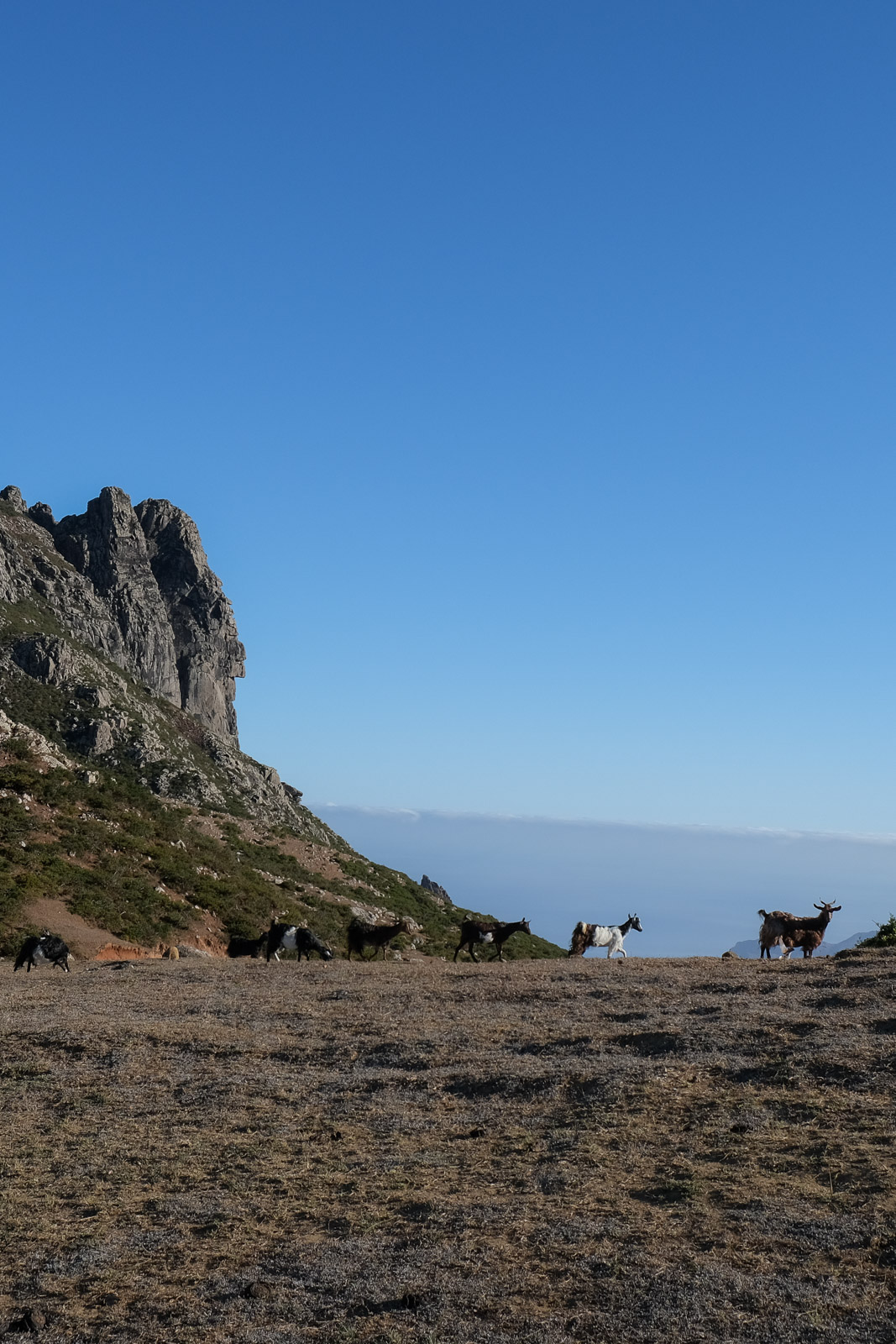
We would be setting camp right there, which meant we would be waking up to that same incredible view. As dinner was being prepared, we were joined by a couple of shepherds spending the season in the mountains. One of them, a young boy, claimed to own around 300 goats.
I still couldn't get the image of the men carrying the baby goats out of my head, and so I asked him, through translation, whether it was possible that some of his goats were the ones being taken, considering how many he had and how difficult it must be to keep track of all the new births. He simply replied that he would know.
Then, to prove his point, he let out a guttural call into the valley. Almost instantly, goats began appearing from every direction, emerging from behind ridges, scrambling down rocky slopes, and running towards us from what had seemed like distant empty mountainsides moments before. It was on of the most surreal and spectacular things I have ever witnessed.
I'm still not entirely convinced this proved his point about being able to notice if a few goats out of 300 were missing, but I absolutely loved the spectacle of it all.
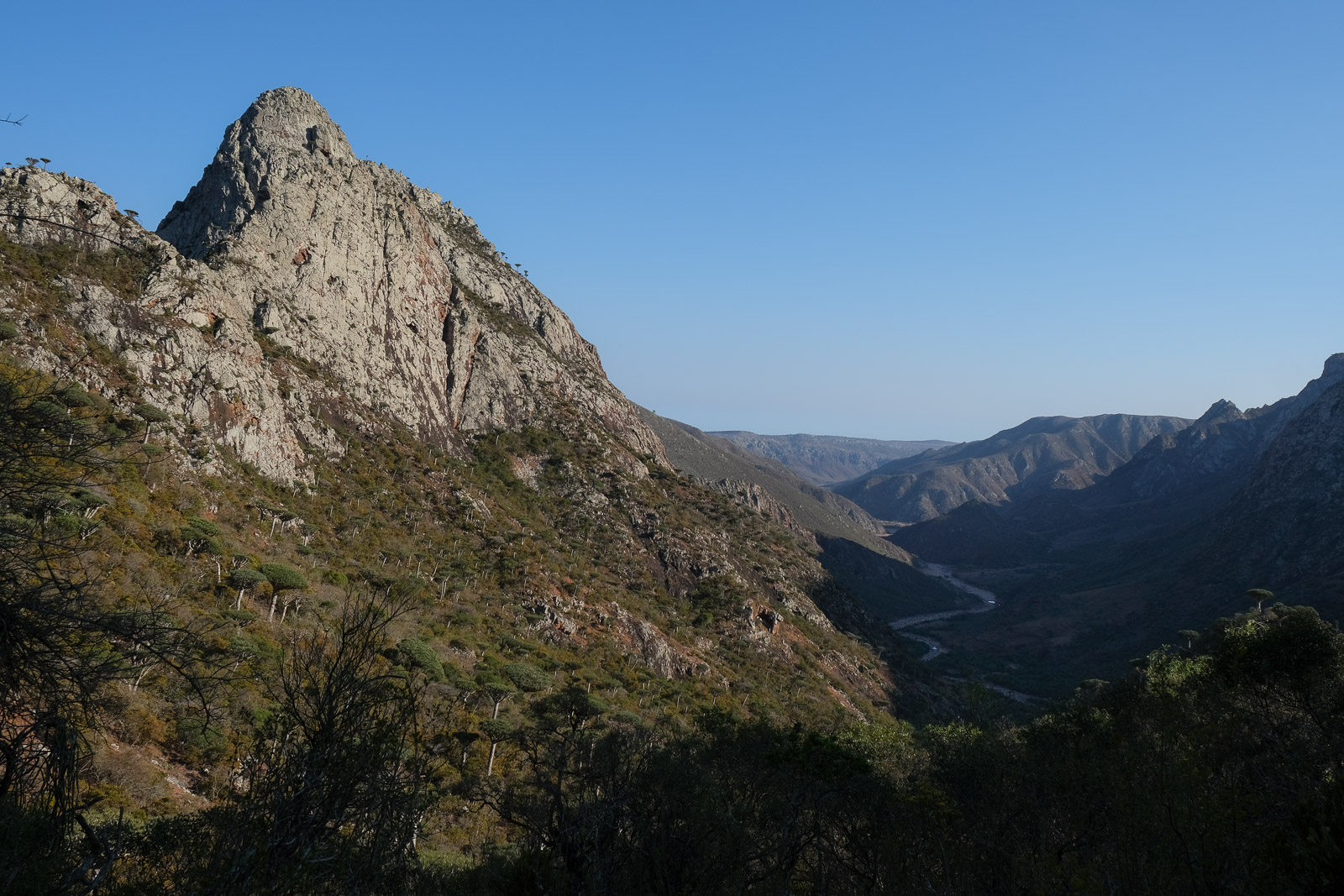
Trek Day 2: Ado Dimalah - Farah Mountain - Ado Dimalah - Wadi Disaqloh
Waking up to a perfectly clear morning, just as one of the shepherds had predicted the night before, we ate breakfast while watching the sunlight slowly spill across the mountainsides.
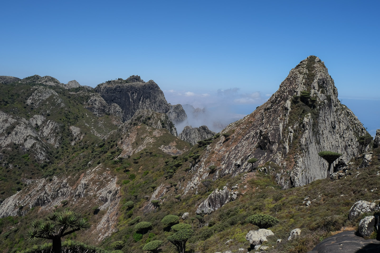
After filling our water bottles, we said our temporary goodbyes to Faisal, and set off with Abdullah to hike up Farah Mountain, a trek that would take roughly four hours round trip. The hike to the summit, the highest peak on the island, felt less like following a defined trail and more like gradually navigating our way through the highlands. The route first winds through a forested section before reaching ridge lines from which you can see further into the valley, all the while being surrounded by peaks dotted with sparse vegetation.
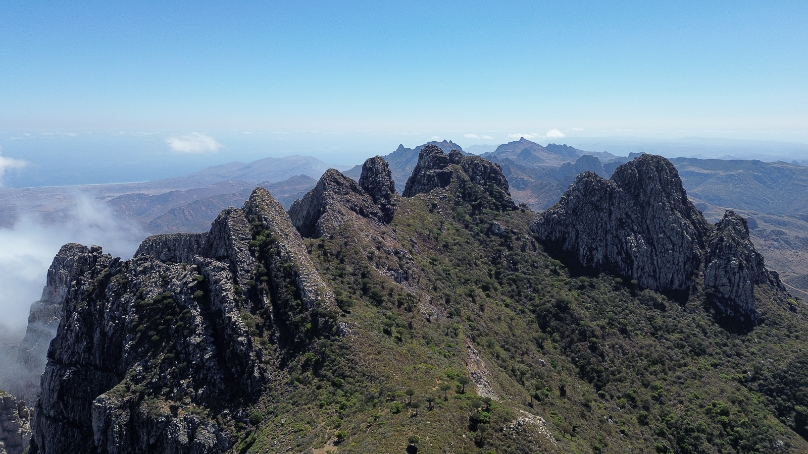
As we gained elevation, the landscape became increasingly expansive, the views stretching farther with every step. Along the way, we passed open valleys, small shepherd huts, and the occasional wandering cow. The final stretch toward the summit was extremely exposed, with loose rock and steep sections that required quite a bit of scrambling over massive boulders that didn't always feel entirely stable beneath our feet.

Just before the final push to the summit, we reached a saddle overlooking one of the surrounding peaks at eye level, its slopes covered in dragon's blood trees. It was absolutely breathtaking, and honestly worth the climb for that view alone.
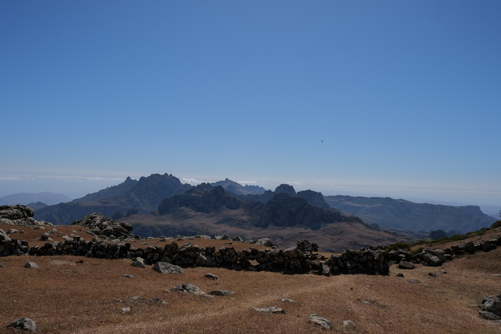
From the summit itself, the panorama opened completely: endless ridge lines, jagged peaks, Hadiboh visible in the distance, and beyond it all, valleys falling away toward the sea.
By the time we made it back to the camping spot, we were completely parched and out of water. Socotri heat is really not to be underestimated, especially up in the exposed mountains.
From there, we began descending toward the valley floor, where a dried riverbed cut through the landscape and Faisal would be waiting for us with tea and lunch. Turns out we were in for a refreshing surprise: a large natural pool surrounded by smooth pale pink rocks, the water so clear you could see straight to the bottom and deep enough to fully immerse yourself.
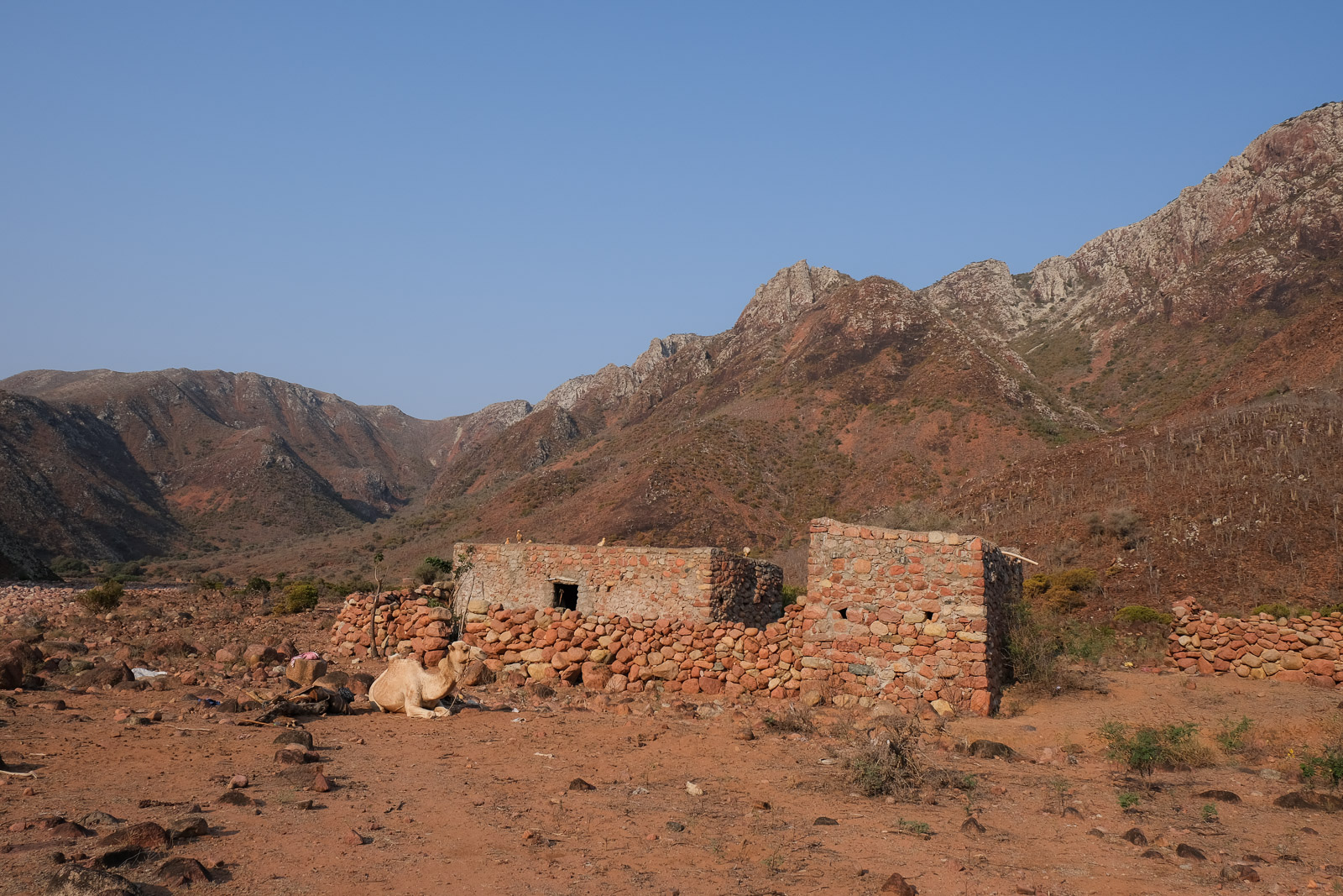
As we ate lunch, we were joined by another man living in the mountains. He invited us to pass by his home as we continued our way farther into the valley, where his brother would most likely welcome us and offer fruit for their garden.
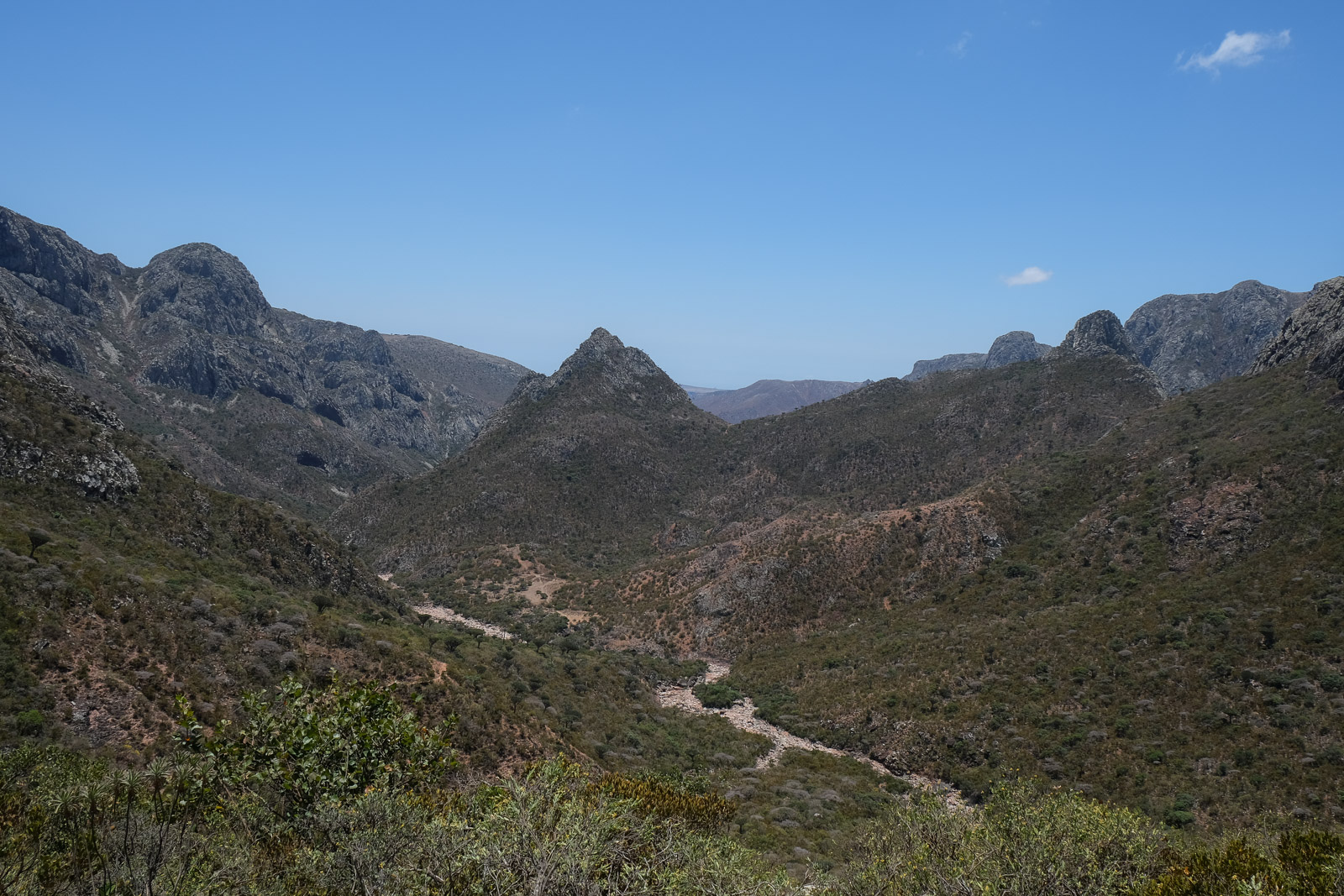
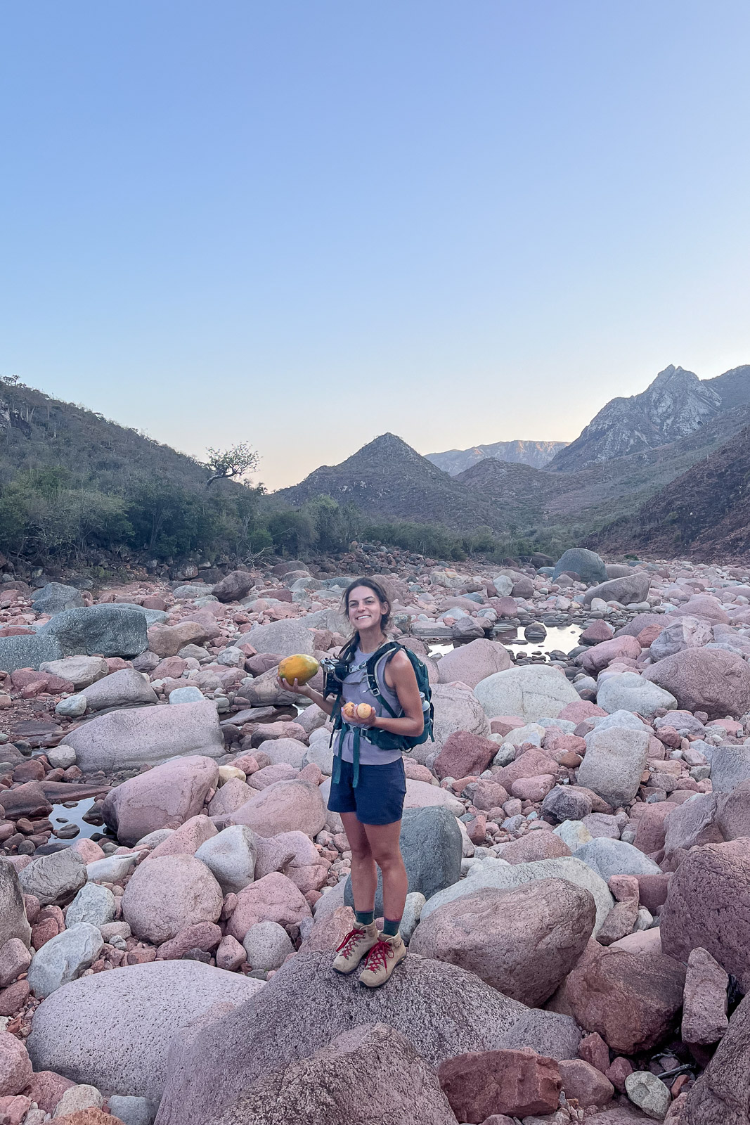
From the lunch spot, the trail continued into the valley before climbing back up to another ridgeline with views of more mountains and scattered dragon's blood trees. After another few hours of hiking, we reached the bottom of Wadi Disaqloh and made our way to a small stone house surrounded by an explosion of greenery.
I'm not entirely sure what I had expected to find in the middle of these dry mountains, but it certainly wasn't a thriving garden of tropical fruit: Socotri bananas, mangoes, enormous papayas, and guava trees heavy with fruit. I could genuinely rave about those guavas for days. I must have picked and eaten at least ten of them right there on the spot. Even the papaya, usually not a fruit I particularly enjoy, tasted incredible. We eventually left carrying three massive papayas and a handful of guavas. It remains one of my favourite memories from the entire trip.
We finally reached our campsite for the night — a clearing on the valley floor beside a cluster of abandoned stone buildings — completely exhausted and very much in need of a wash. Thankfully, another large freshwater pool lay only a few minutes from camp, tucked among the rocks. After a full day of hiking in the heat, it felt incredible.
Our lunchtime companion had found his way back to us for dinner, which that evening was fire-roasted goat. As an appetizer, we were served a rich goat broth that honestly became one of my favourite dishes on the island. And for dessert: the fresh papaya from his garden!
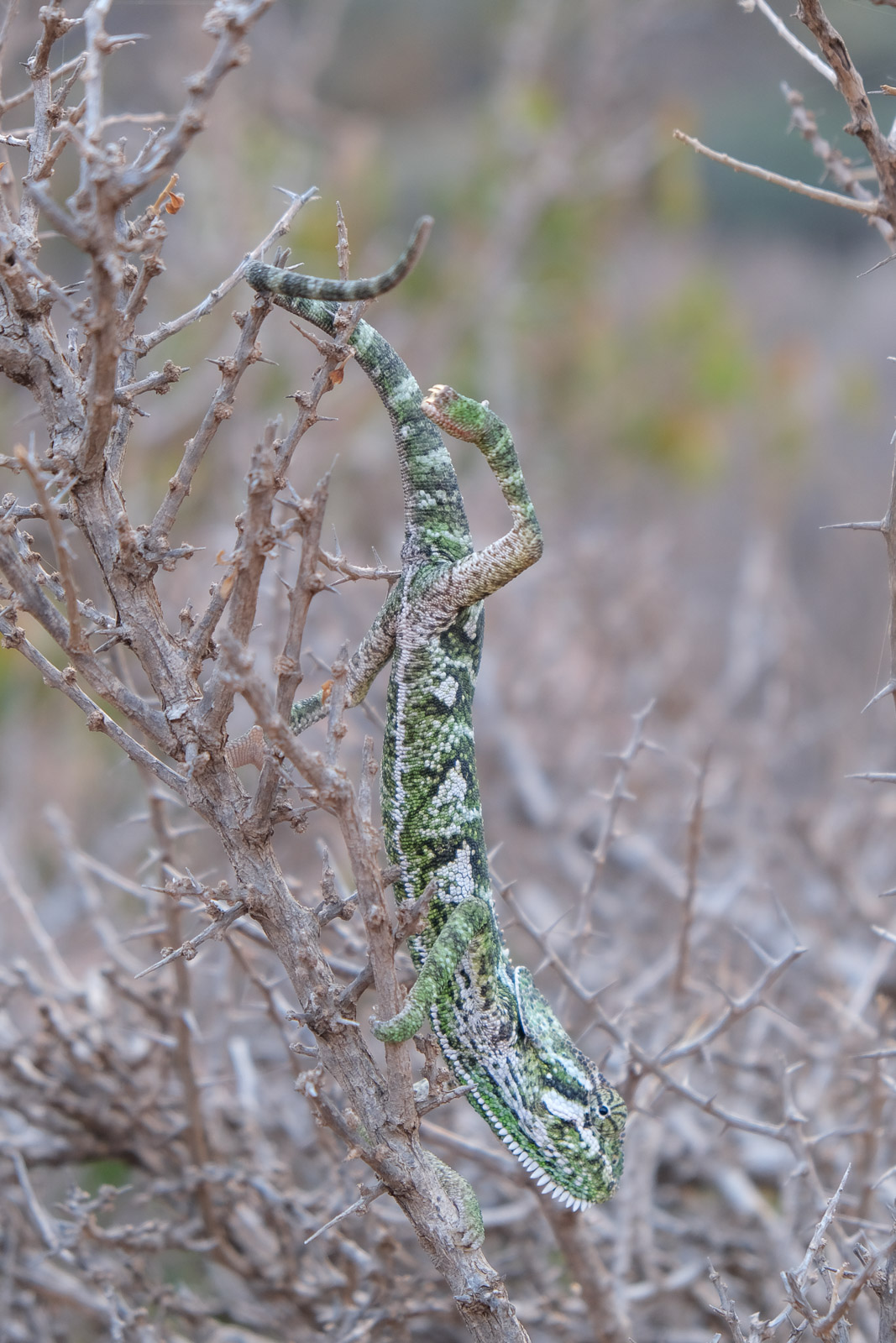
We were also visited by a small chameleon that seemed perfectly content climbing all over me. It was the first chameleon I had ever, and watching it slowly move across my arms in the glow of the fire somehow made the entire day feel even more surreal.
Trek Day 3: Wadi Disaqloh - Firmhin
Our final day on the trek began with one last steep climb toward Firmihin Forest, the largest remaining concentration of dragon’s blood trees on the island.
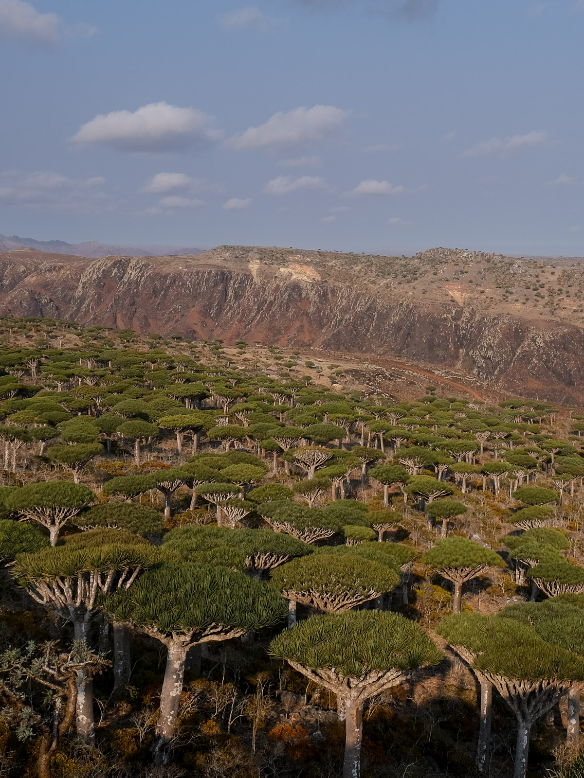
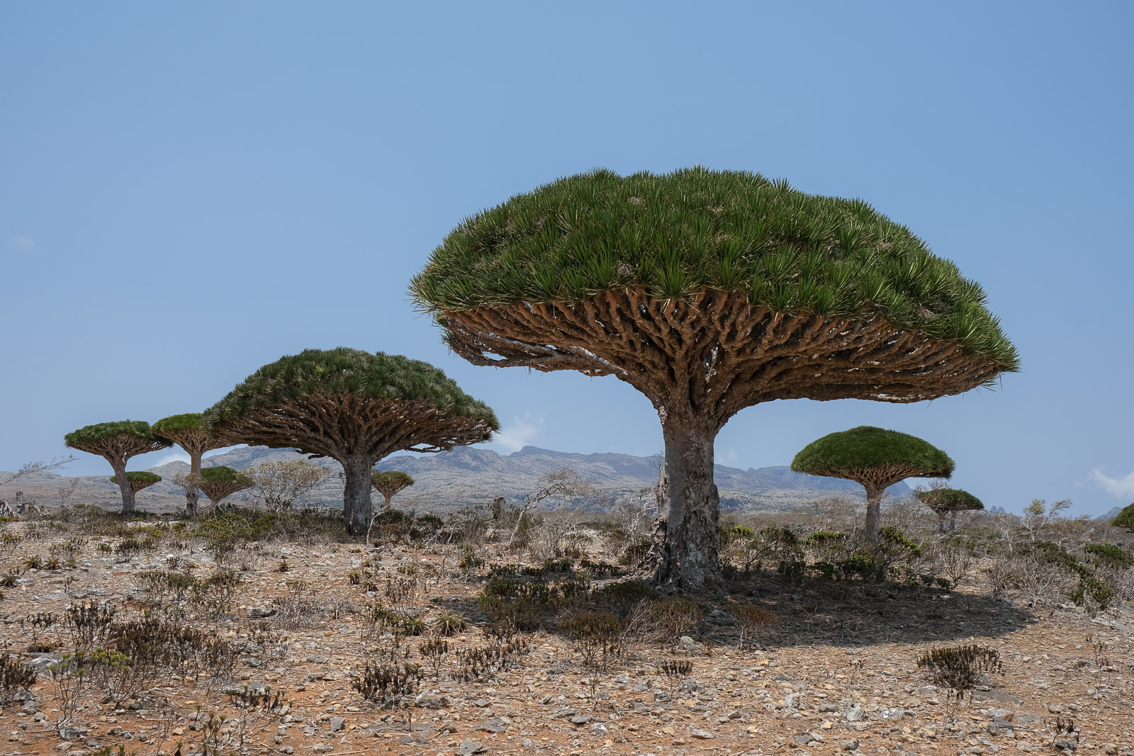
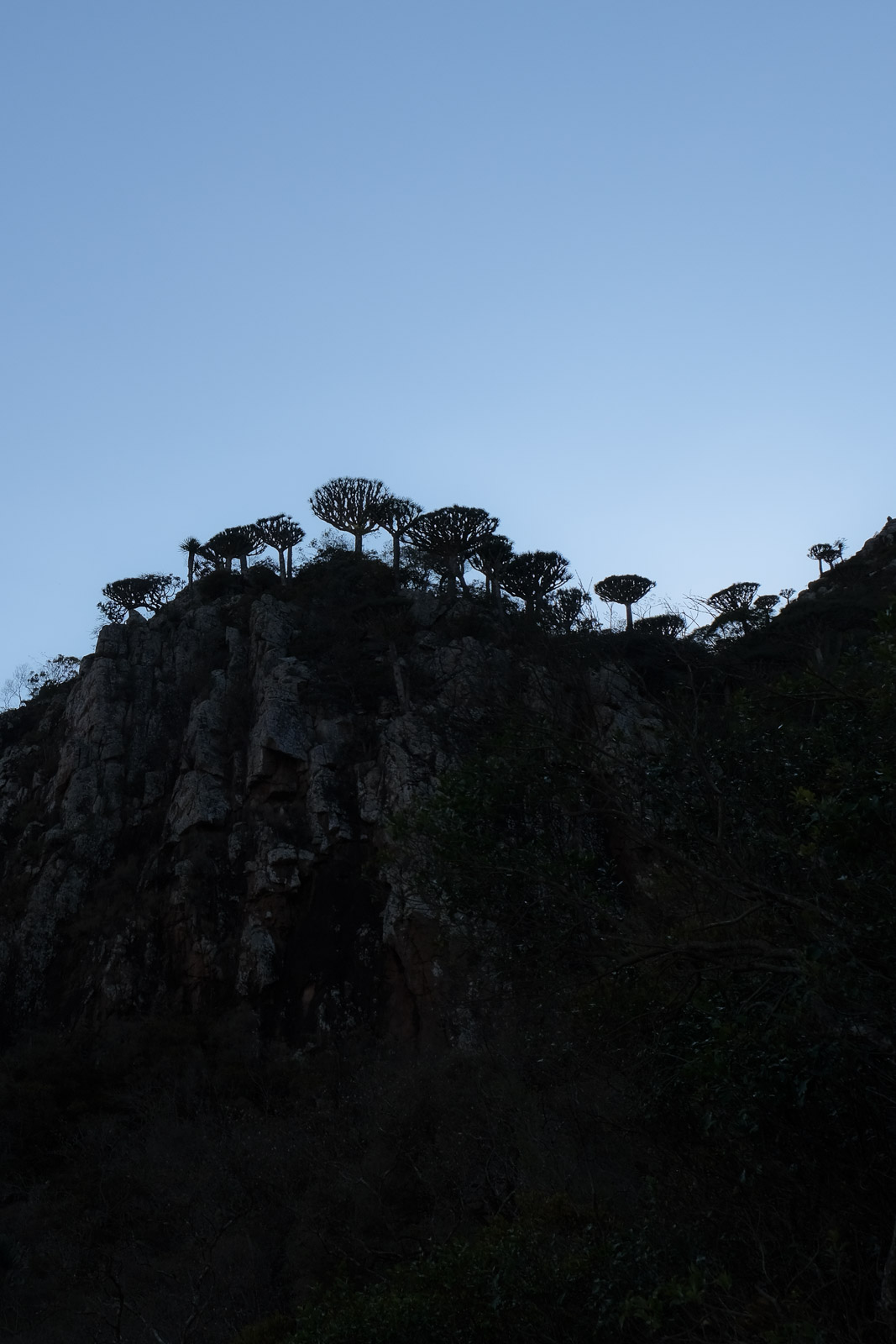
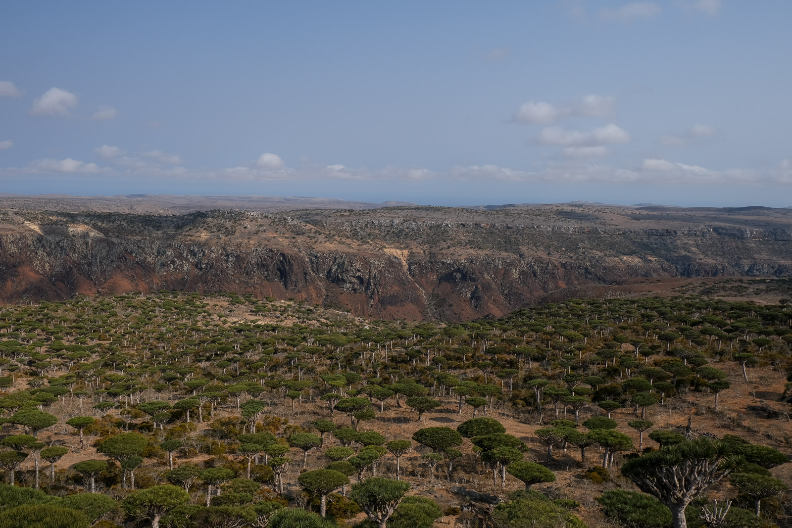
Firmihin Forest
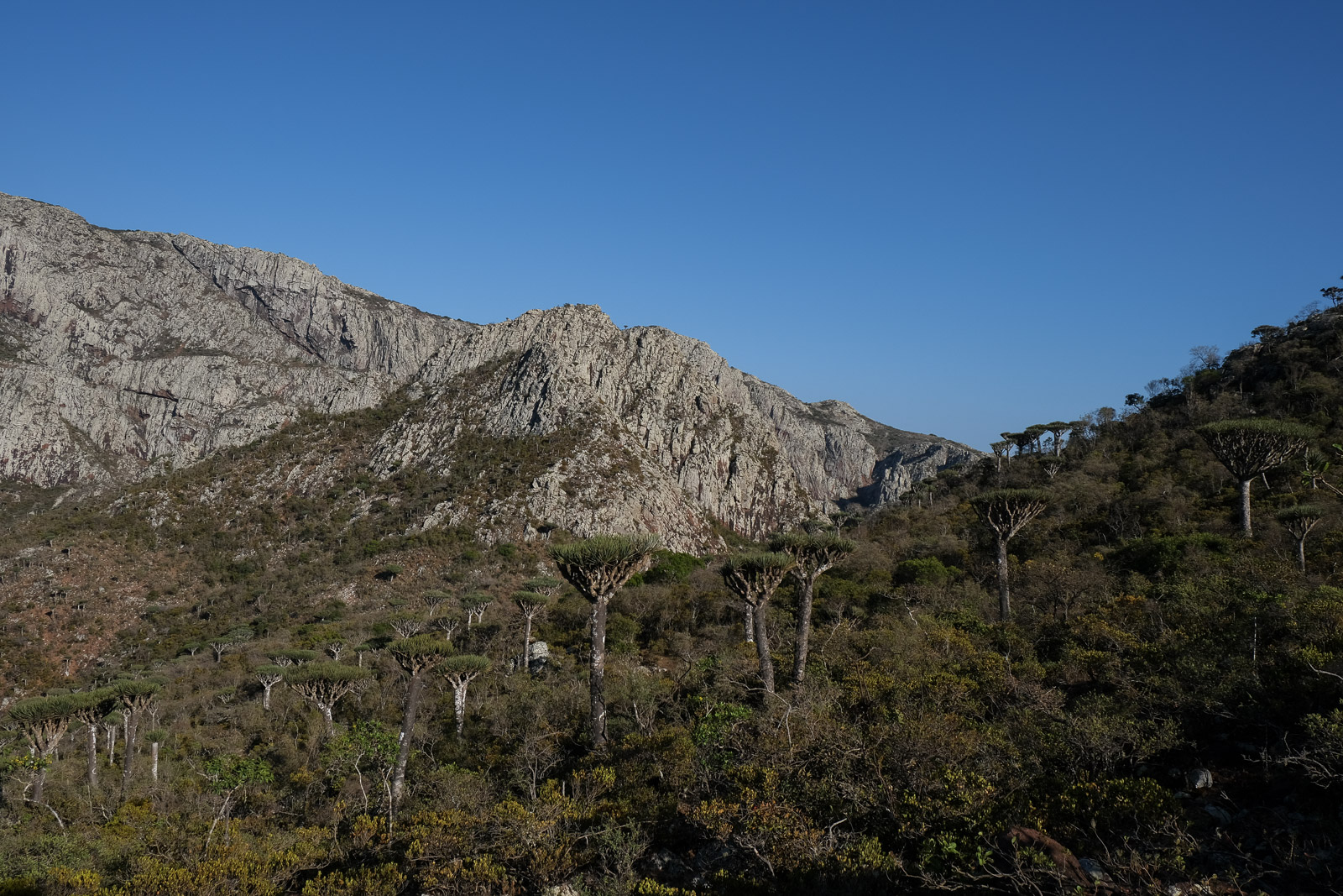
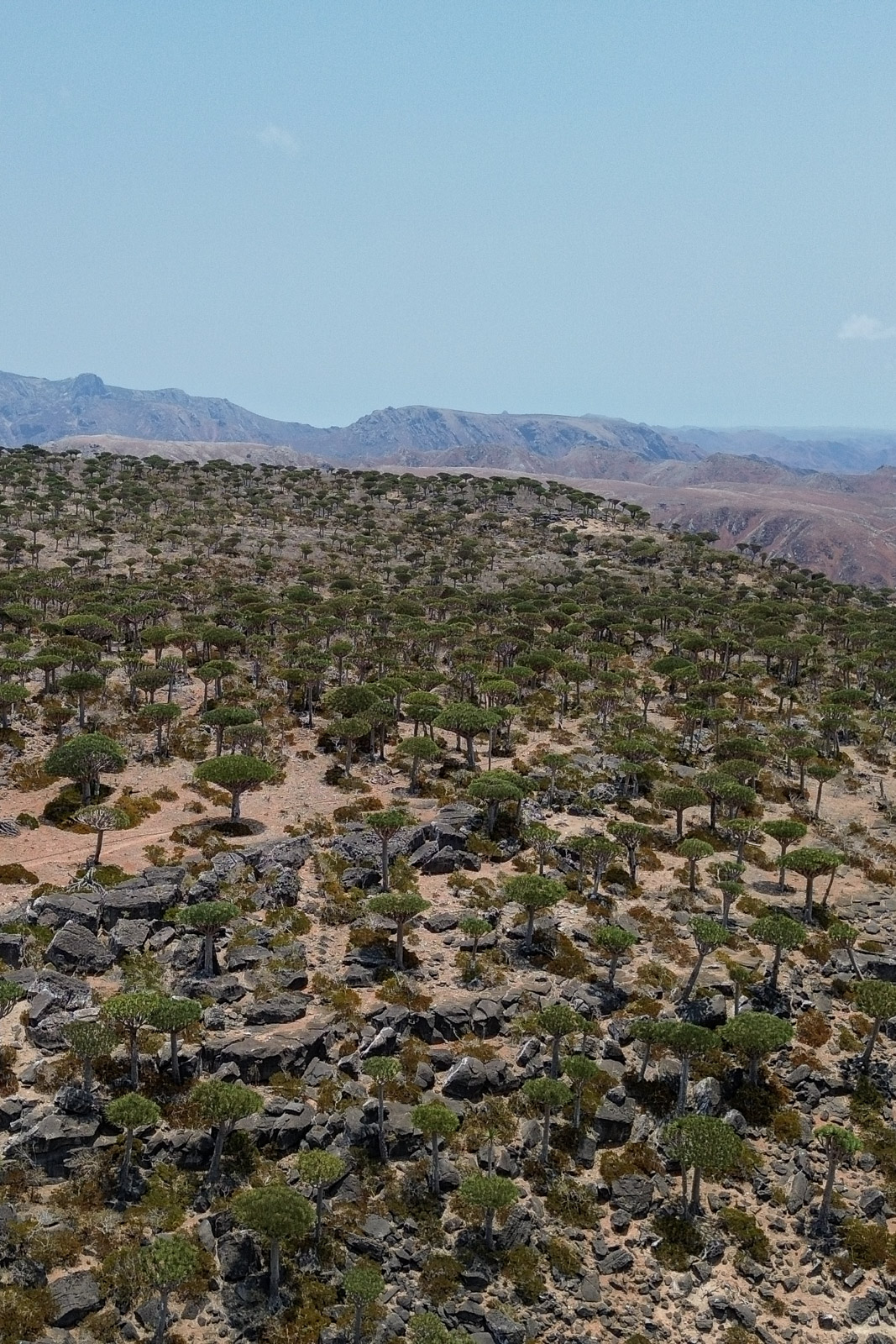
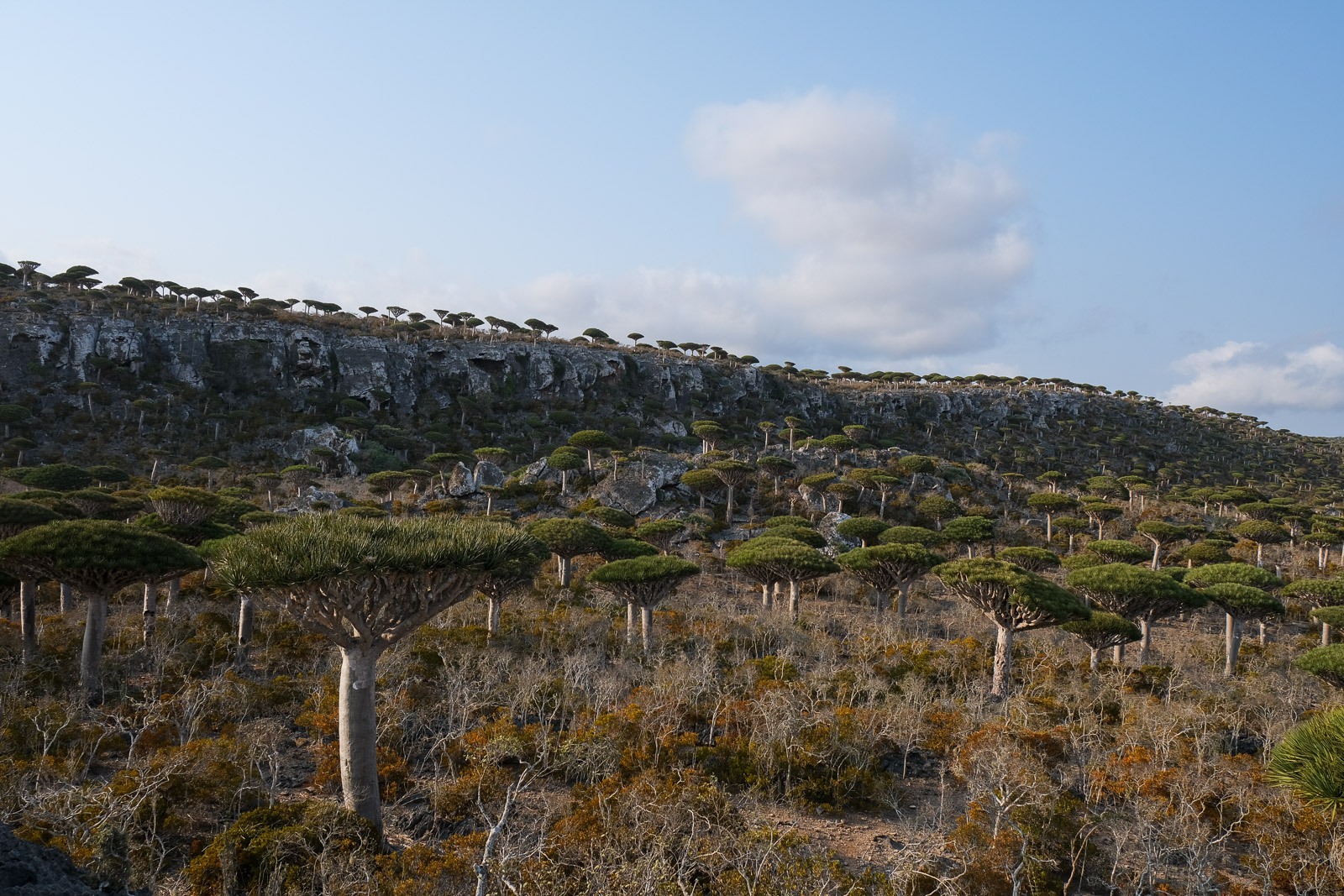
Firmihin Forest is one of the most iconic landscapes on the island. Spread across a high plateau, a forest of dragon's blood trees with their dense umbrella-shaped canopies rise above the rocky terrain like giant mushrooms.
Mist and moisture carried through the mountains help sustain the forest, creating the conditions that allow these endemic species to persist in an otherwise dry climate.
The designated camping area is located on the open plateau almost within the dragon’s blood tree landscape itself, near the tracks coming from the Diksam Plateau. It’s not a formal campground in the traditional sense, but rather a series of open clearings among the trees where guides set up temporary camps. As soon as we arrived, I wandered off in search of the perfect place to pitch our tent and I found exactly what I was looking for: slightly tucked away for privacy, surrounded by dragon's blood trees, with uninterrupted views of the Diksam Plateau in the distance.
We set off almost immediately to explore the forest. The plateau is split by a deep valley that cuts dramatically through the landscape, so rather than a continuous woodland, the dragon’s blood trees are scattered across rolling limestone terrain interrupted by steep cliffs and sudden drops.
It didn’t take long before we realized we had slightly lost our sense of direction, and quickly understood why there’s an unwritten rule that you should only really explore the area with a local guide - any landmarks can be surprisingly deceptive. Thankfully, we managed to make it back to camp just in time for lunch.
Later that afternoon, we set off properly with a local guide from the area. Within minutes of leaving camp, we were already passing viewpoints that far surpassed anything from our earlier wanderings. It quickly became obvious that we had spent the morning exploring in completely the wrong direction. We had the choice between two different golden-hour viewpoints: one about a twenty-minute walk from camp, the other roughly an hour away. Naturally, we asked if we could reach both, which turned out to be the absolute best decision.
The nearer viewpoint alone was already breathtaking. We stood above a valley blanketed in dragon’s blood trees, looking down onto their umbrella-shaped canopies from above. From there, our guide pointed out the second viewpoint in the distance, and even then, it was hard to imagine how the scenery could possibly become even more impressive.
The walk itself, at times passing through denser clusters of trees, and at others opening onto clearing, was just as memorable as the viewpoints themselves.
At one point along the trail, we heard another group shouting across the valley to our guide, asking for help figuring out how to safely descend from the cliff edge they had reached. I found myself very grateful to be with someone who genuinely knew the terrain.
And then we reached the viewpoint. If the first had taken our breath away, this one left me almost speechless. From there, the forest stretched out in every direction, spilling down valleys, climbing cliffsides, and layering itself across the plateau.
Had we not been determined to make it back to camp in time to watch the sun set behind the Diksam Plateau, we probably could have stayed there for hours simply taking it all in, especially with the warm golden-hour light. But we had a mission, and so what had been a slow, leisurely walk deeper into the forest quickly turned into a much faster-paced return through the fading light. We made it just in time to watch the sun dip below the horizon. Five minutes later would have been too late.
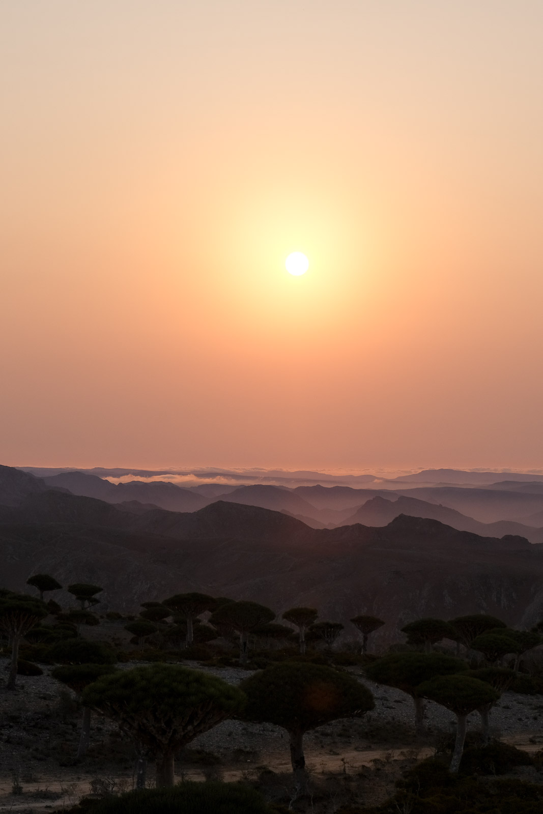
Sunrise among the dragon’s blood trees is absolutely not something to miss, though it is definitely worth deciding the night before exactly where you want to watch it from. I found myself running around in every direction at dawn trying to find a slightly elevated spot where I could photograph both the trees and the first light appearing over the horizon. I never quite found the perfect location, but the early wake-up was worth it nonetheless.
After spending close to 24 hours around Firmihin Forest, we climbed back into the jeep, said our goodbyes to the camel, and began the drive toward the island’s western coast. What followed was an incredibly bumpy first hour of driving: descending deep into a valley before climbing back out again along an even rougher mountain road. But once we reached the top of the Diksam Plateau, we were greeting by an impressive view opening onto the canyon below.
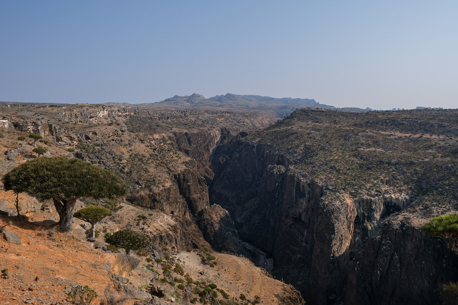
As we continued our drive, we stopped by a large stone-walled enclosure that protects one of the island’s dragon’s blood tree nurseries. The non-profit project was started by a group of Dutch foreigners working alongside local communities in an effort to help regenerate the species. One of the biggest challenges facing the trees today is that young saplings rarely survive in the wild, largely because non-native free-roaming goats graze on them long before they are mature enough to withstand the harsh environment.
We were told it can take well over a decade for a young dragon’s blood tree to become resilient enough to survive outside protected areas. Without intervention, very few new trees are naturally reaching adulthood. Standing there, after spending days surrounded by these ancient trees, it was difficult not to think about how fragile the landscape really is, and to accept that the trees currently standing will not be replaced when they reach the end of their 500-year life cycles.
Qalansiyah
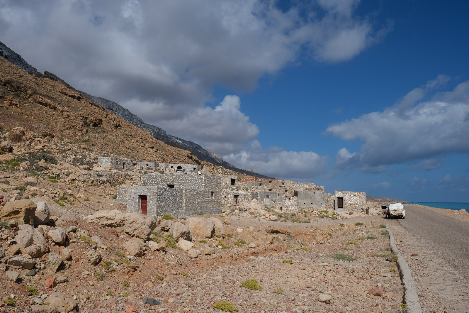
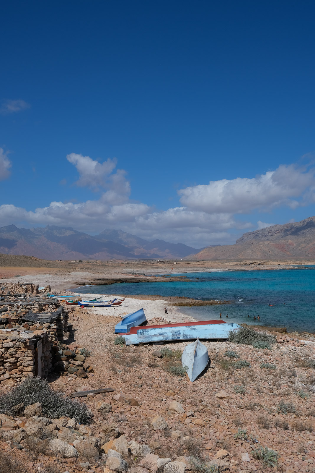
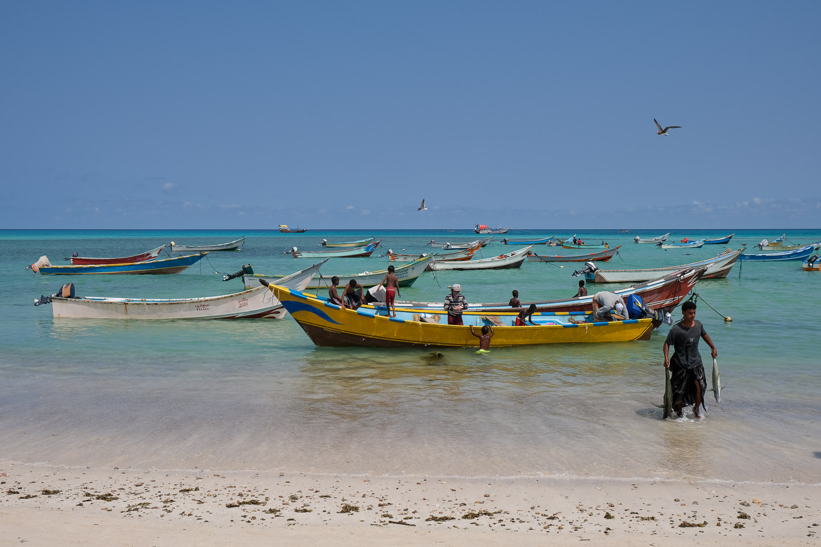
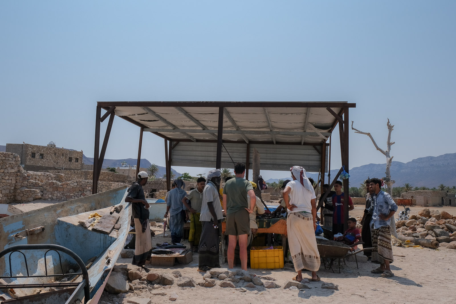
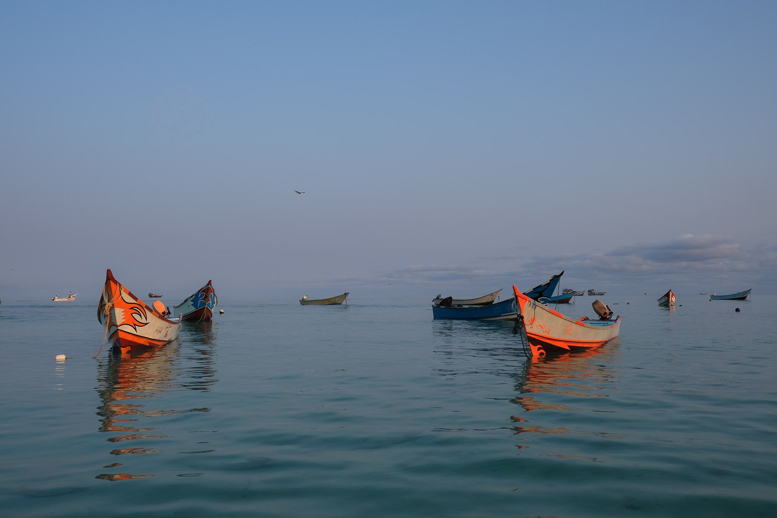
Qalansiyah, situated on the western side, is the second largest town on the island. It has a completely different feel from Hadiboh, sitting between turquoise lagoons and white sand beaches with colourful fishing boats lining the shore.
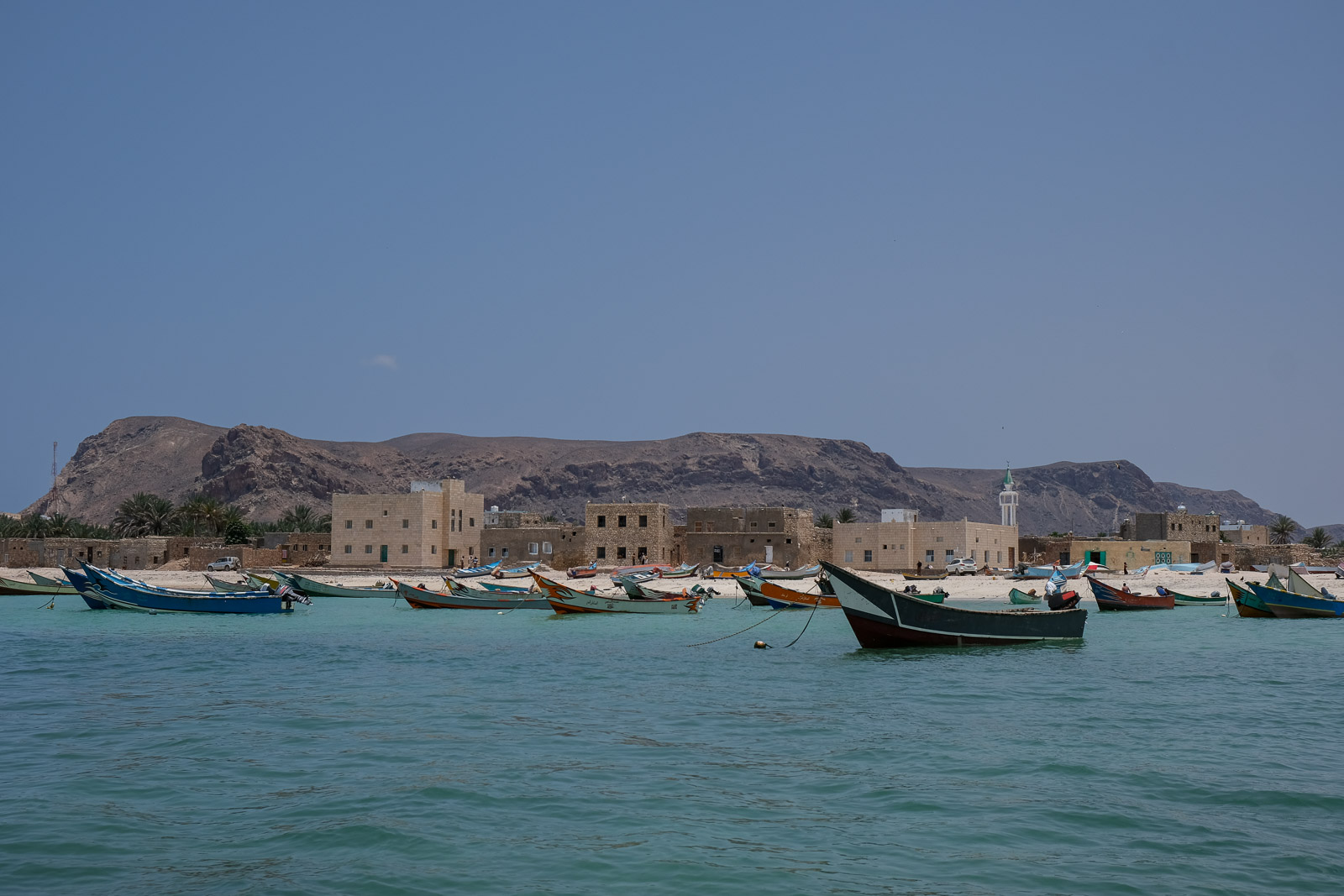
The town also seemed to have a livelier atmosphere, with fishermen bringing in fresh catches, children playing along the waterfront, and narrow streets winding between simple stone homes. After days spent among dry mountains and dragon's blood trees, arriving on the western coast reminded us of the island's diversity in climate and geography.

As beautiful as the setting was, it was unfortunately difficult to ignore the amount of trash that had accumulated in the small pond formed by the sea inlet, a sobering reminder of how fragile the island's ecosystems are in the face of limited waste management and increasing tourism.
After unsuccessfully searching through a small local shop for lemons, we made our way down to the beach to hand-pick fresh fish straight from the boats as they returned from sea. After much deliberation, we settled on a fish called Kanaad (كنعد / كنعده), mostly because we were specifically looking for something that would be good fried with lemon and garlic. It was a dish Karam used to prepare when he was younger while spending time in his family's beach town of Rimal, in Syria, and so we were excited at the idea of recreating it here with the freshly caught fish.

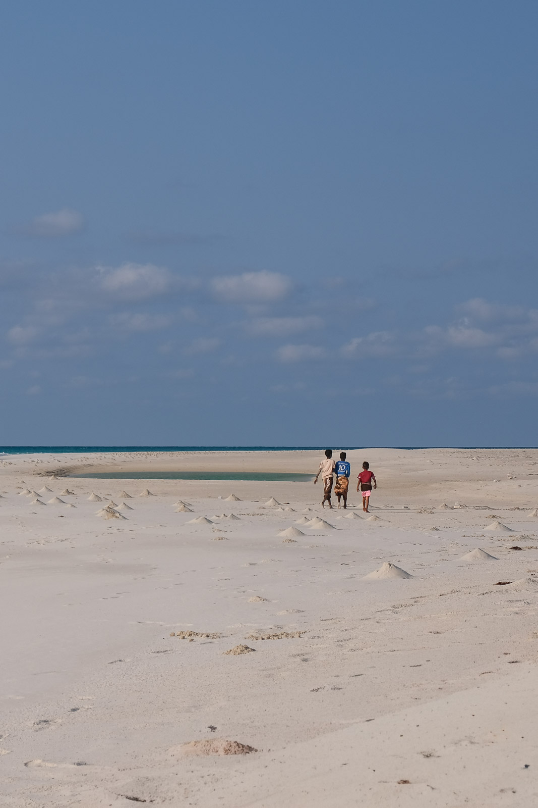
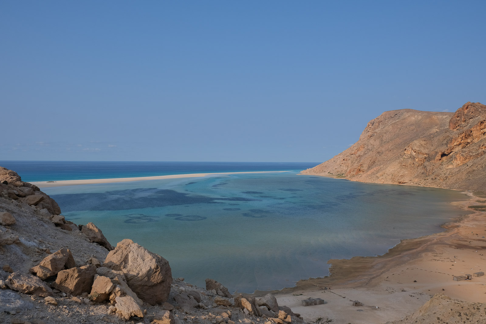
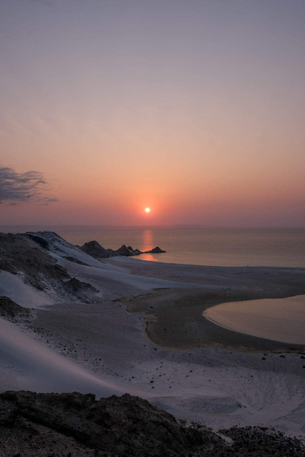
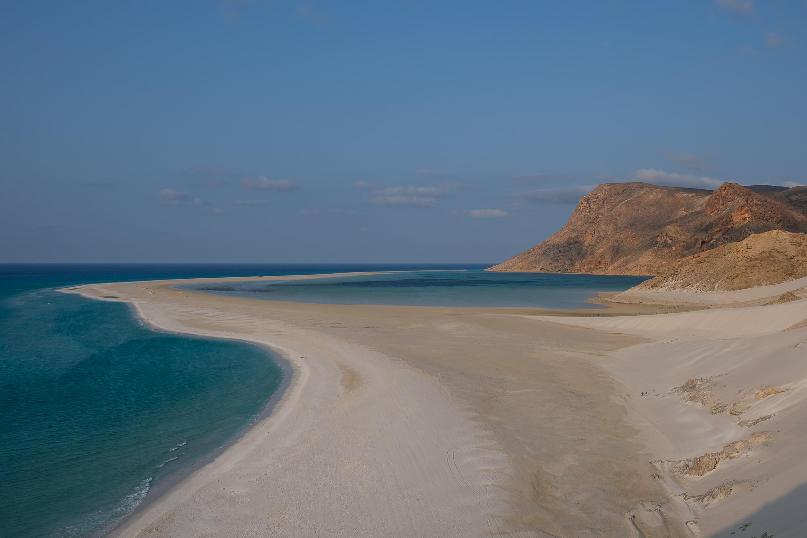
Detwah Lagoon
Just a short drive away, we reached the top of a dune overlooking Detwah Lagoon. It is one of the island's most striking coastal landscapes, where a long sand spit curves outward into the sea, forming a shallow turquoise lagoon sheltered from the open sea. At low tide, much of the water recedes, exposing sandbanks and shallow pools, while at high tide the water is so clear and calm that ripples in the sand and marine life beneath the surface are completely visible.
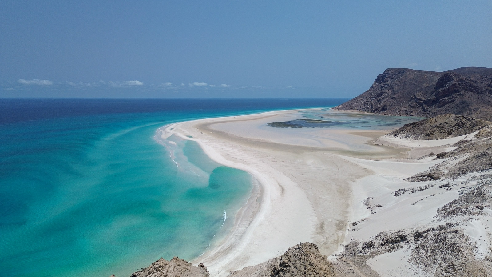
What makes Detwah especially beautiful is the contrast between the bright white sand and the most vivid shade of blue water. The lagoon constantly changes with the tides, revealing pathways that seem to disappear and reappear throughout the day.
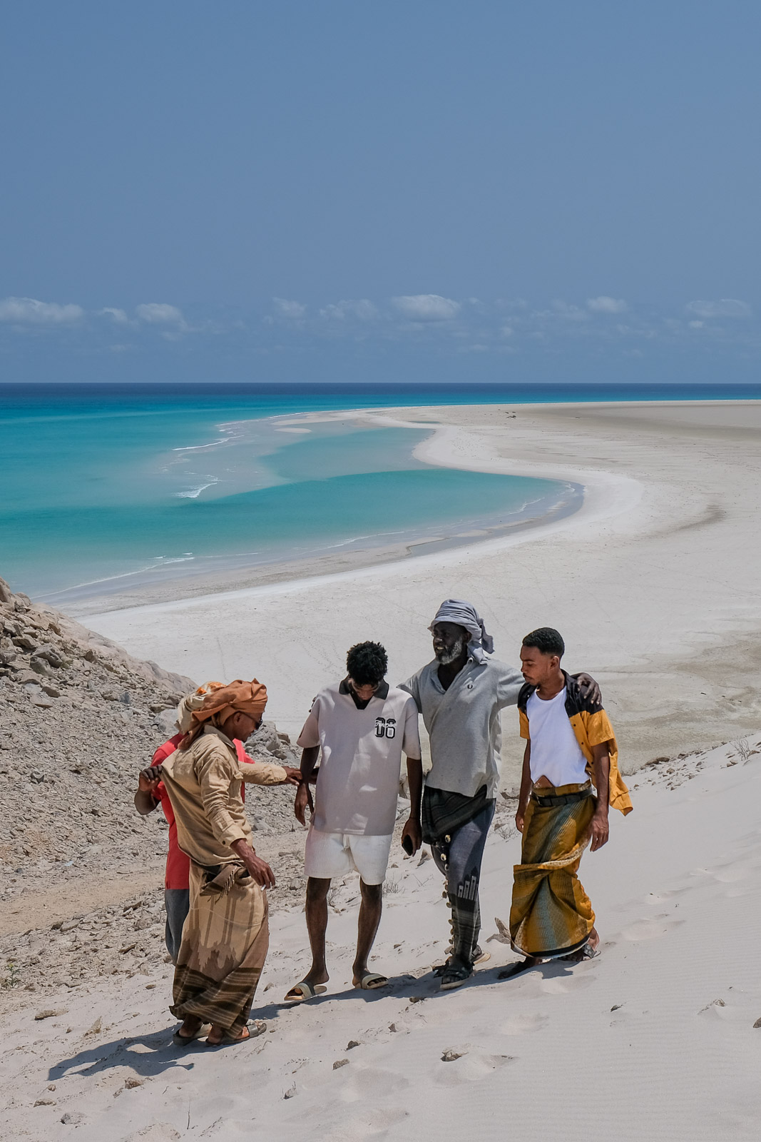
From the top of the dune, we descended on foot toward the beach and spent the next few hours wandering along the shoreline and diving into the water whenever it became too tempting. I never stopped being amazed by the colour and clarity of the water - easily the most beautiful beach I had ever set foot on.
That afternoon, we set up camp behind the lagoon, where we would spend the next two nights. This was one of the more established camping areas we had experienced, with several simple picnic shelters, basic outhouse-style toilets, and even showers (our first of the trip!). In practice, any group passing through the area would be camping along this same stretch of beach.
Abu Sultan and Faisal had been slowly preparing me for it all week, knowing how much I had come to value the solitude of our journey, especially in the Hajhir Mountains, where, aside from the occasional local, we hadn't encountered anyone else.
Somewhere along the far side of Detwah Lagoon, beneath the cliffs, lives a man named Ellai (or Abdullah, depending on who you ask) who has become somewhat of a local legend among visitors to the island. He is said to have been born in the cave overlooking the lagoon and to have spent much of his life living there. Visitors are usually welcomed with tea, stories about his life, and elaborate seafood spreads featuring crab, scallops, and whatever fresh catch has come in that day.
While exploring Qalansiyah, however, we learned that he no longer actually lives in the cave, but instead stays in one of the town’s stone houses and rides out to the site by motorcycle most days. Knowing that made the whole experience feel a little more performative to us, and in the end we decided not to visit.
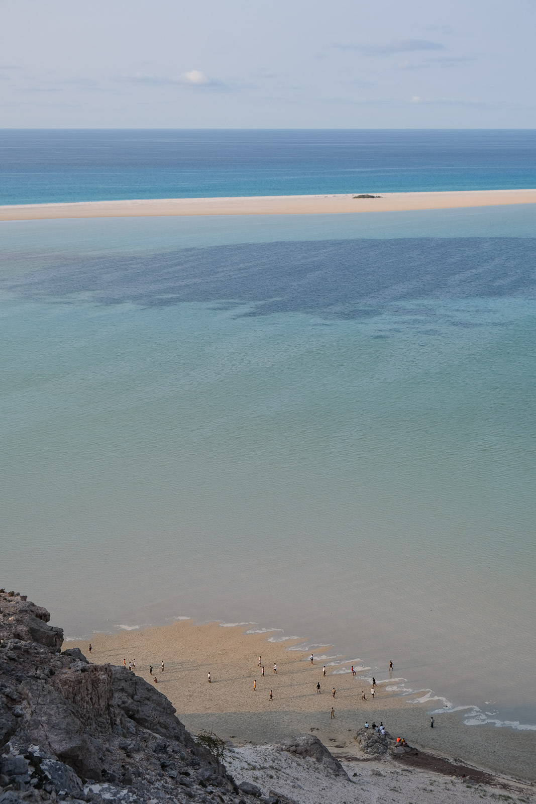
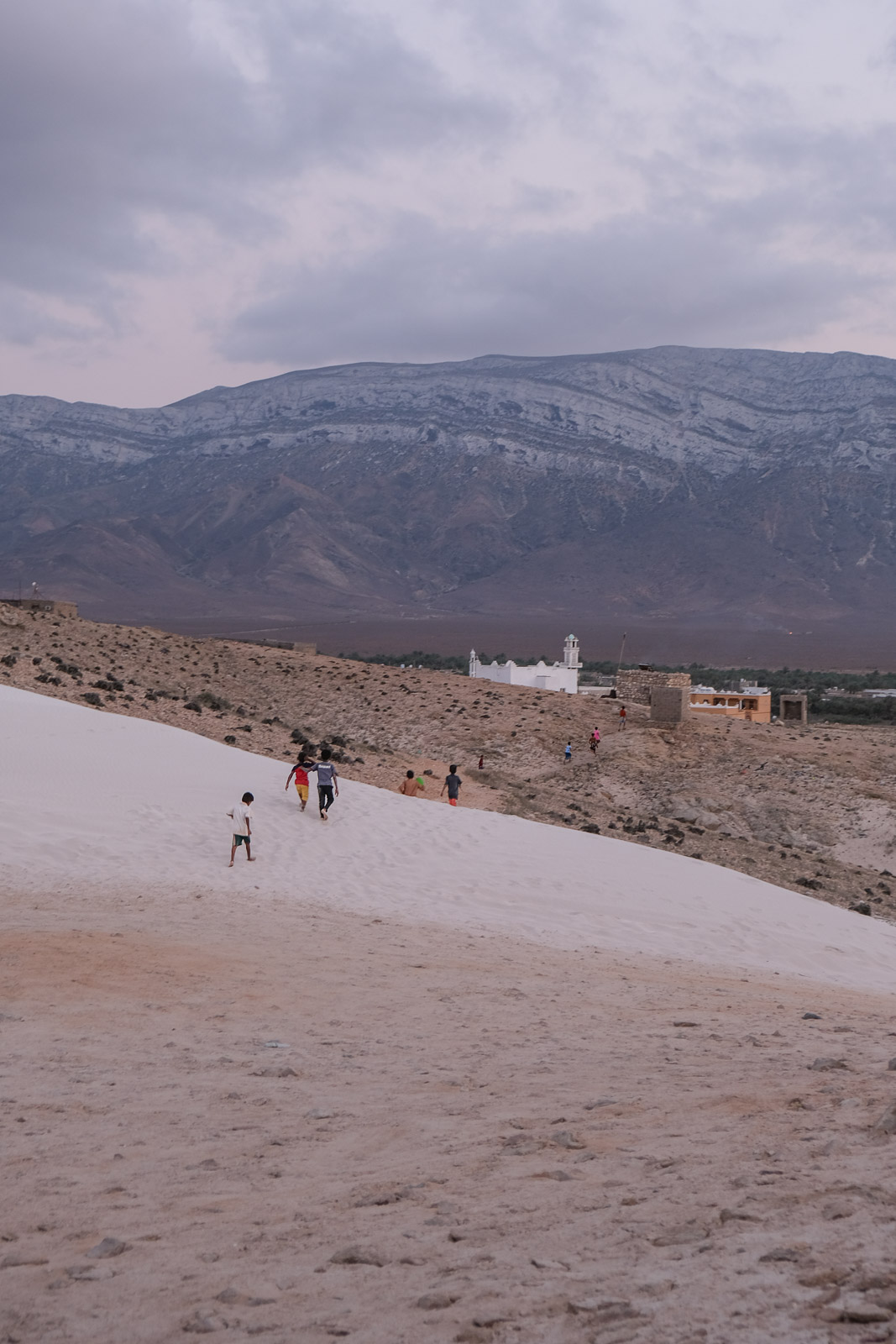
Instead, we made our way to one of the nearby cliffs during golden hour, watching as the local boys down on the beach kicked off their evening football (soccer) games while we waited for the sun to drop toward the horizon. From up there, the whole shoreline felt alive, with voices carrying in the wind, and, somewhat hilariously, even a couple of goats scrambling up the rocks as if they wanted a better view of the action too.
Shu'ab Beach
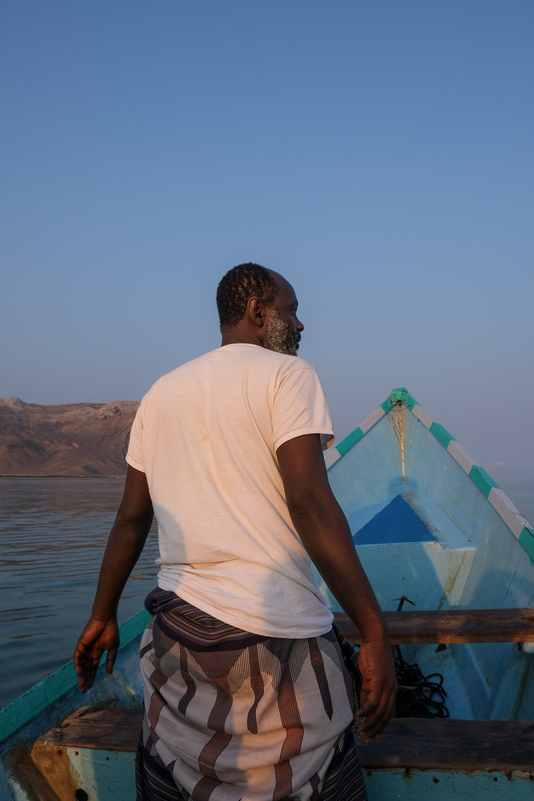
The next morning, I had convinced Faisal to leave bright and early so we could be among the first boats departing from Qalansiyah toward Shu'ab Beach, often described as even more beautiful than Detwah Lagoon, though I struggled to imagine how that could be possible.
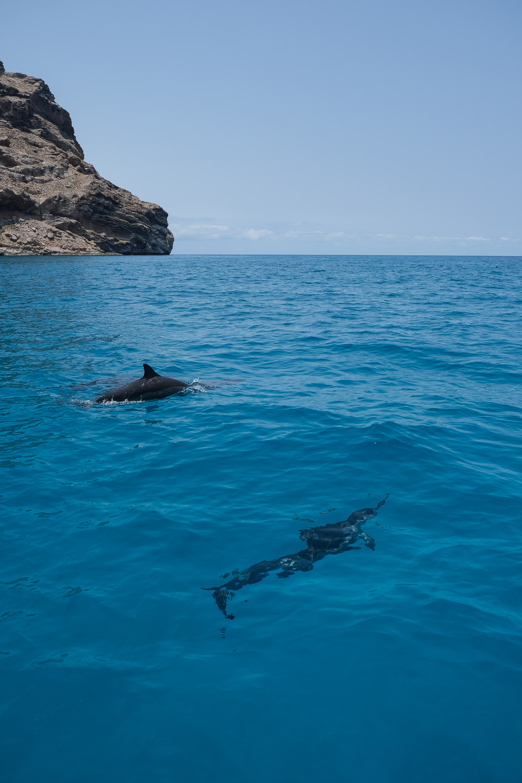
In the early light, we set off across the calm turquoise water, the boat cutting a quiet path along the coast. On these crossings, it’s common to spot pods of dolphins or even rays (including leopard stingrays and blue-spotted ribbon-tailed rays) gliding just beneath the surface in the crystal-clear sea. The conditions were exceptionally calm that morning, though we didn’t see any wildlife, which was to be expected as our guides had warned us they tend to be more active later in the morning.
The journey itself was still beautiful: passing small hidden coves, stretches of white sand, and sea-carved caves, with the water almost glowing as it shifted between shades of blue. As we drew closer to the beach, I was surprised to see a few tents set up on the beach. Had I known, I would have loved to spend the night there instead of two nights at the busy campground. If anything, I felt a slight sense of regret and disappointment that our guides had not thought to propose it as an option.
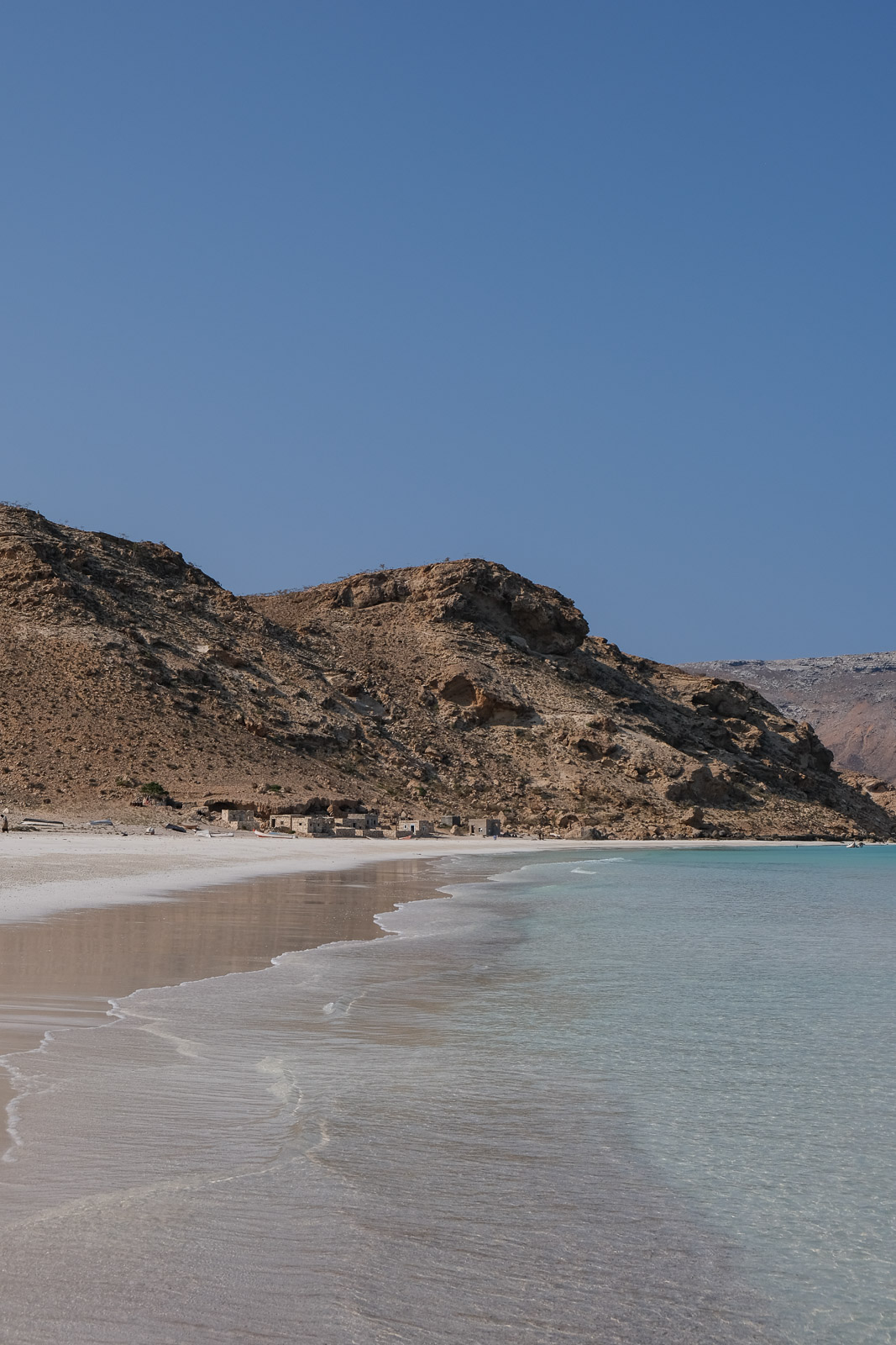
Shu'ab Beach is one of the most remote stretches of coastline on the island, accessible only by boat from Qalansiyah. The sand seems to run on endlessly beneath dramatic cliffs, with distant hints of two small fishing settlements. It is undeniably beautiful in its vastness, though I still personally preferred the varied, changing landscape of Detwah Lagoon.
We ended up spending more than three hours on the beach, walking all the way to one of the small fishing villages at the far end. The water was amazing to swim in, and surprisingly, the beach never felt crowded. Another option would have been to spend less time on the main stretch of beach and instead ask the boat to stop at one of the smaller sandy coves for a quieter experience.
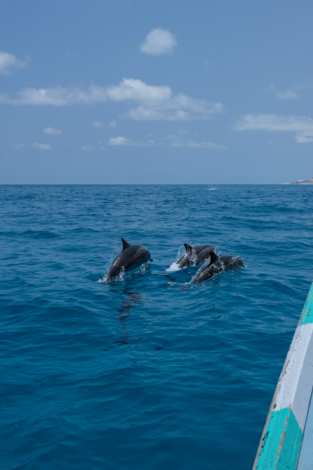
The ride back to Qalansiyah was incredible. Although the sea had become slightly rougher, we suddenly found ourselves surrounded by what must have been hundreds of dolphins, leaping around the boat in every direction. We were completely stunned. I had expected maybe a few dolphins if we were lucky, not an entire pod putting on such a spectacular show! Definitely another highlight of the trip.
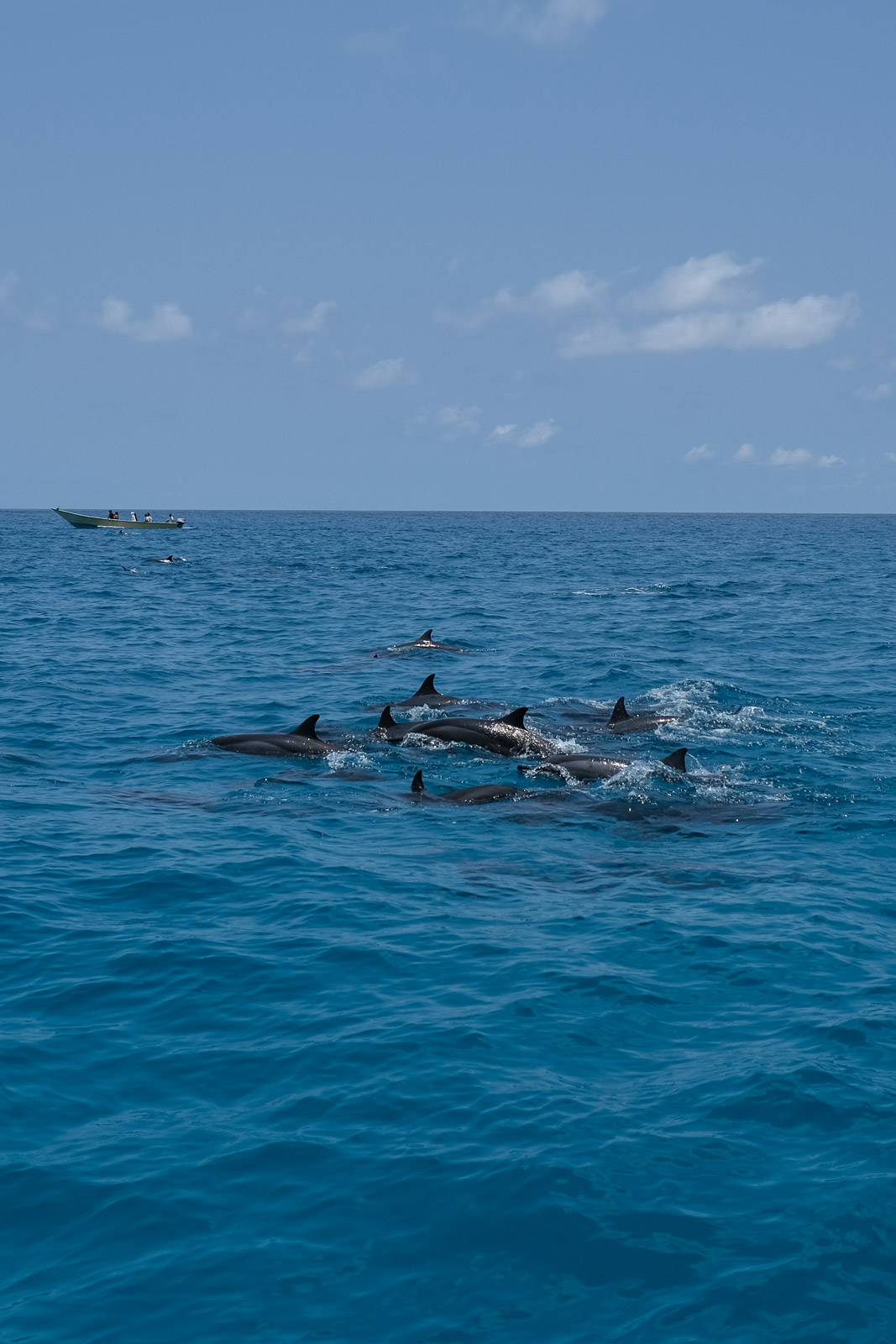
If I had to recommend an itinerary, I would suggest heading to Shu'ab early on the first day, perhaps even trying to catch a fish or two along the way for dinner, and spending the night camping on the beach. Then, leaving the following morning around 10 or 11 a.m. would likely offer the best chance of seeing the large dolphin pods while sea conditions are still relatively calm. An afternoon, sunset, and morning by Detwah Lagoon would definitely be enough time to fully appreciate the area.
And just like that, it was our final evening on the island. This time, we chose to watch the sunset from the top of the same dune where we had first caught sight of Detwah Lagoon. We had the entire place to ourselves, and it felt like the perfect way to end our time on the island.
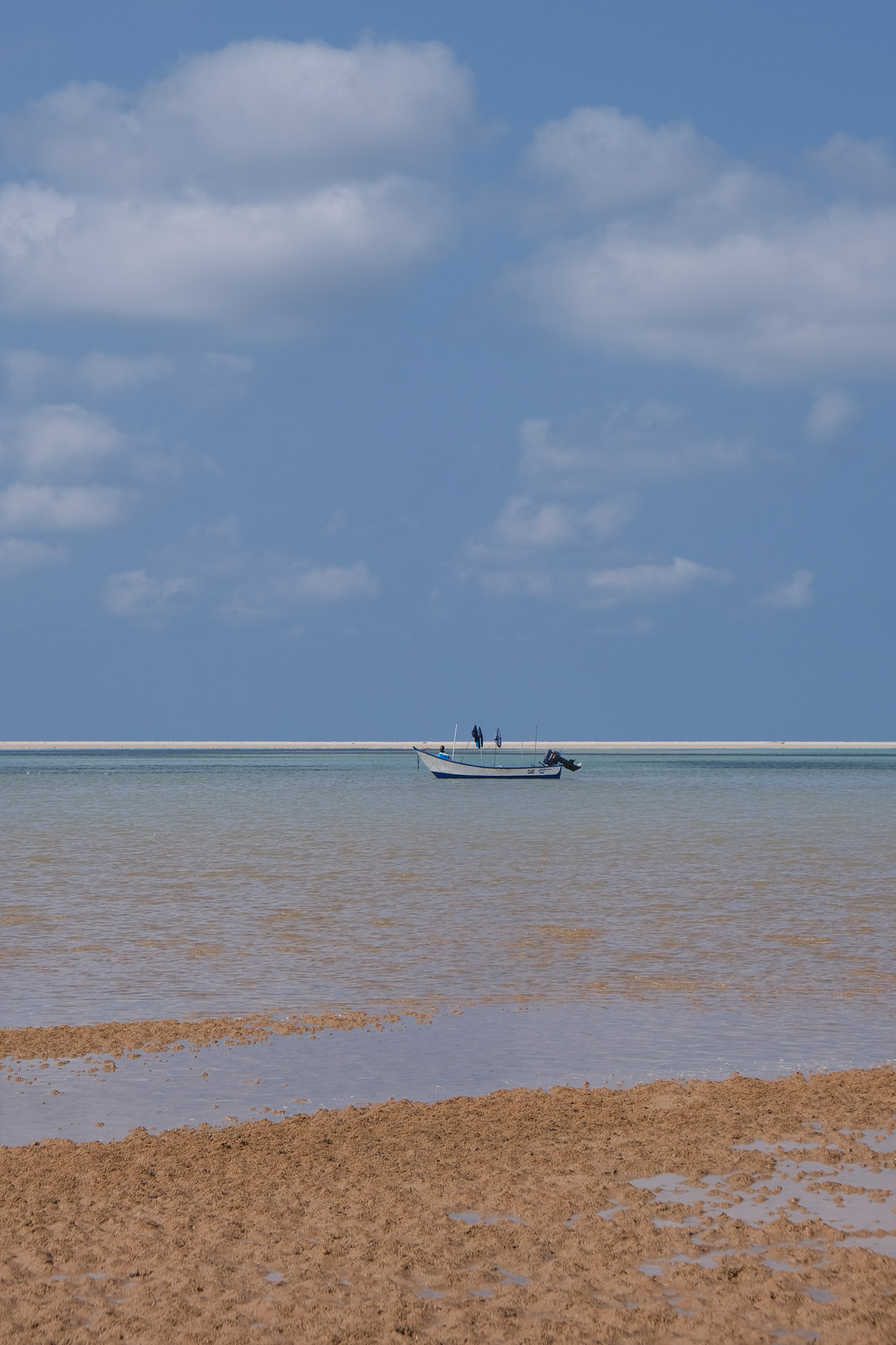
Our final morning was spent slowly savouring the last of the Socotri bread Abu Sultan would make for us, watching the tide gradually pull the water back toward the sea, quietly coming to terms with the fact that our adventure was nearing its end.
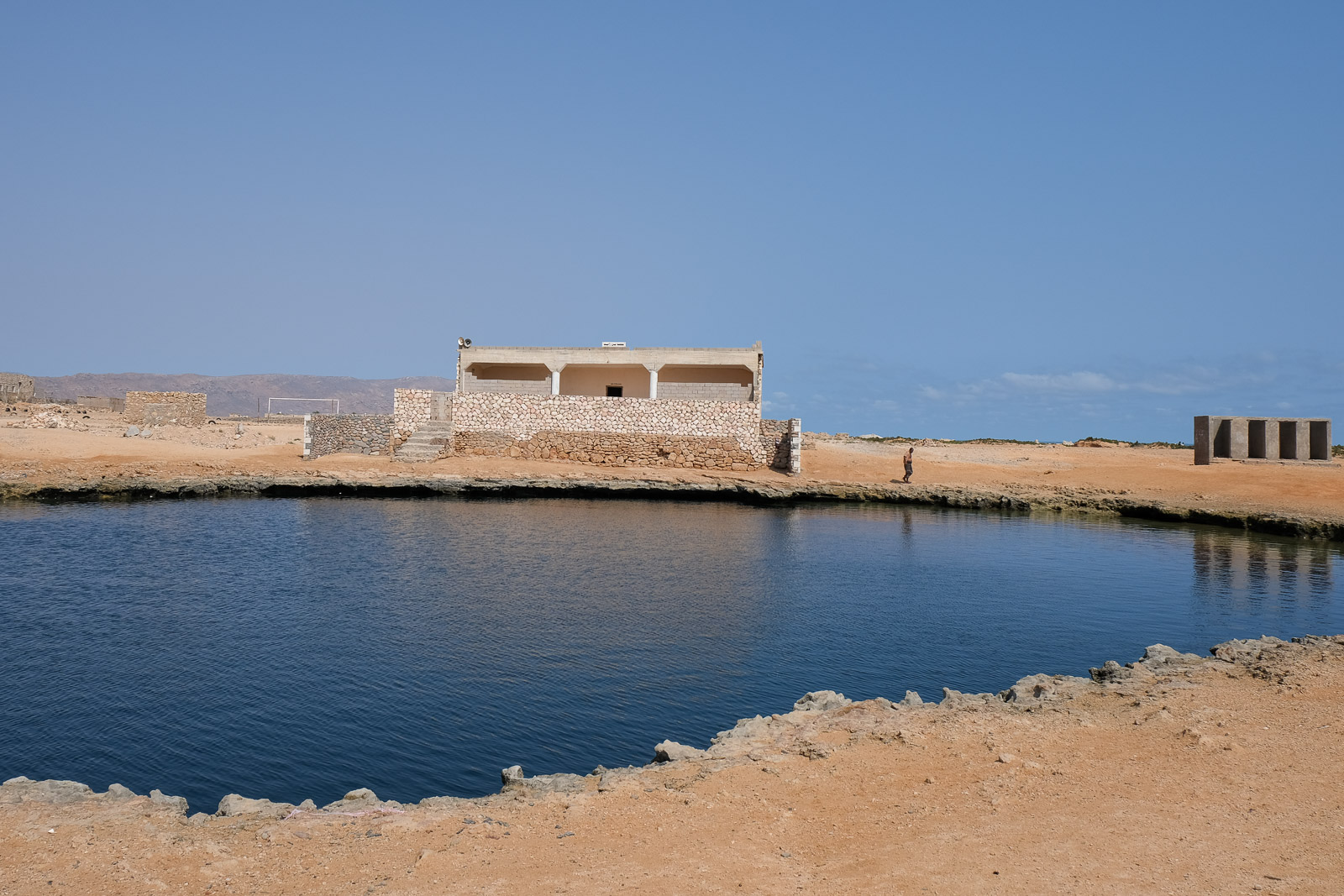
On the drive back to the airport, we stopped through a couple of small villages to catch one final glimpse of everyday life on the island. At one point, we passed a large pool naturally filled by the incoming seawater, where children were swimming and playing as though it were the town’s public pool.
Our final stop was at a small school, where I handed out the last of the colouring pens I still had tucked away in my bag.
And just like that, after one final cup of tea, our week on Socotra had come to an end.

More than anywhere else I have travelled, Socotra felt like a place shaped entirely by landscape — wild, isolated, and still largely untouched.
It is incredible that landscapes like these could exist all on the same island. Nearly every day seemed to reveal something entirely different: towering dunes collapsing into the sea, freshwater canyons hidden within dry mountains, cliffs dropping into turquoise lagoons, and forests of dragon’s blood trees unlike anything I had ever seen before.
One week simply wasn't long enough.
إلى اللقاء